Xishuangbanna Pt. II: The Elephant Whisperer

(To read Part 1 of my Xishuangbanna trip, click here!)

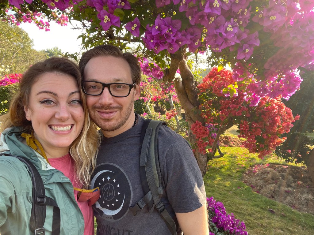
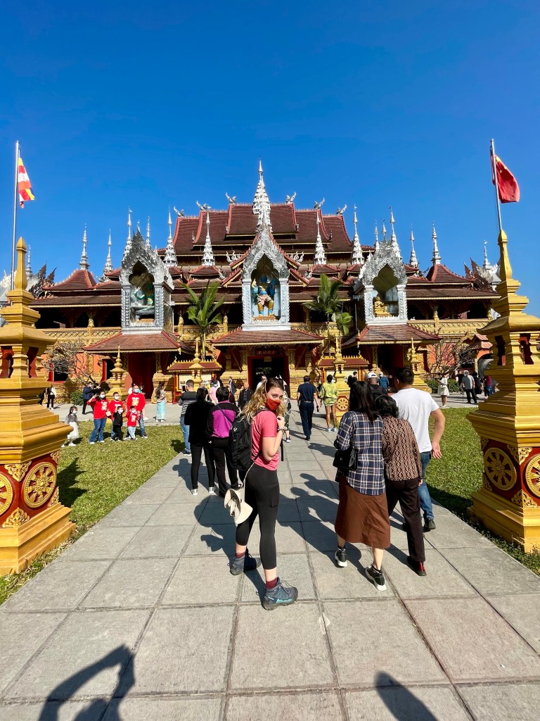
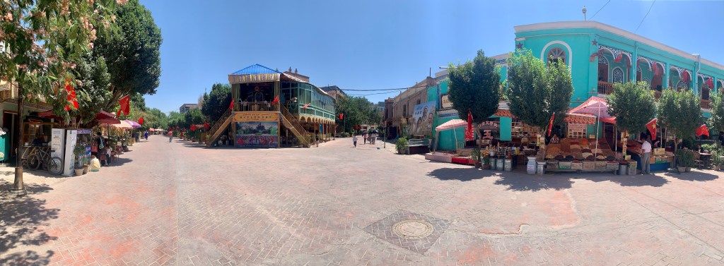
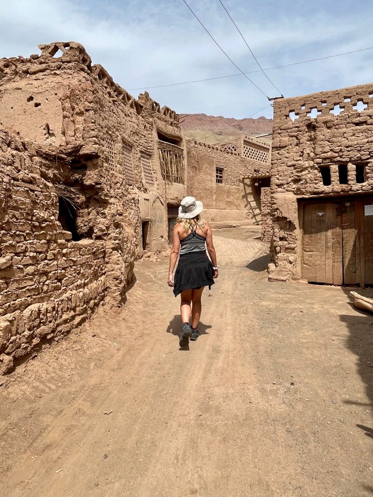
One of the amazing things about living and traveling through China is the variety of destinations available to you. There are giant metropolitan cities (larger than most American cities!) that I’d never even heard of before moving here, the classic Chinese tourism spots (the Great Wall, the Terracotta Warriors, the pandas, etc), and the various STUNNING natural wonders, but one of my favorite places to visit are the smaller local villages. Though I likely would not be able to find or reach these villages on my own, by traveling the country with tour groups I’ve been able to get a glimpse into a side of China that I would not have been able to see otherwise. While down in Xishuangbanna, we were able to have one such experience when we went to visit a village that is home to one of the local minority cultures: the Bulang people.

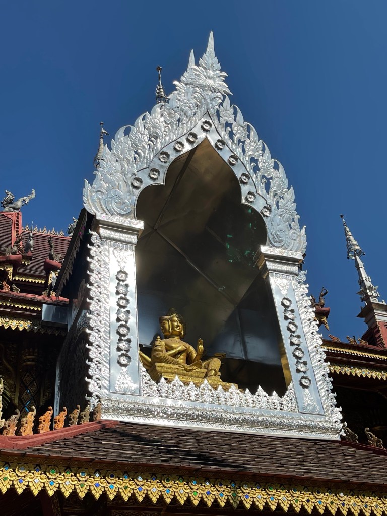
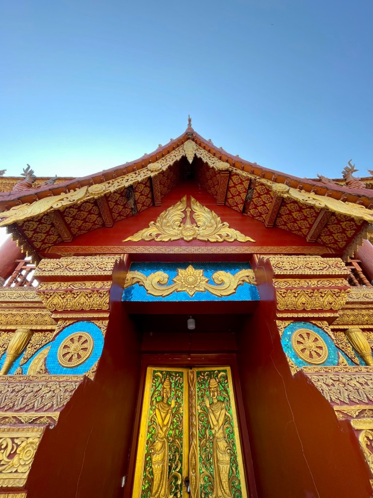
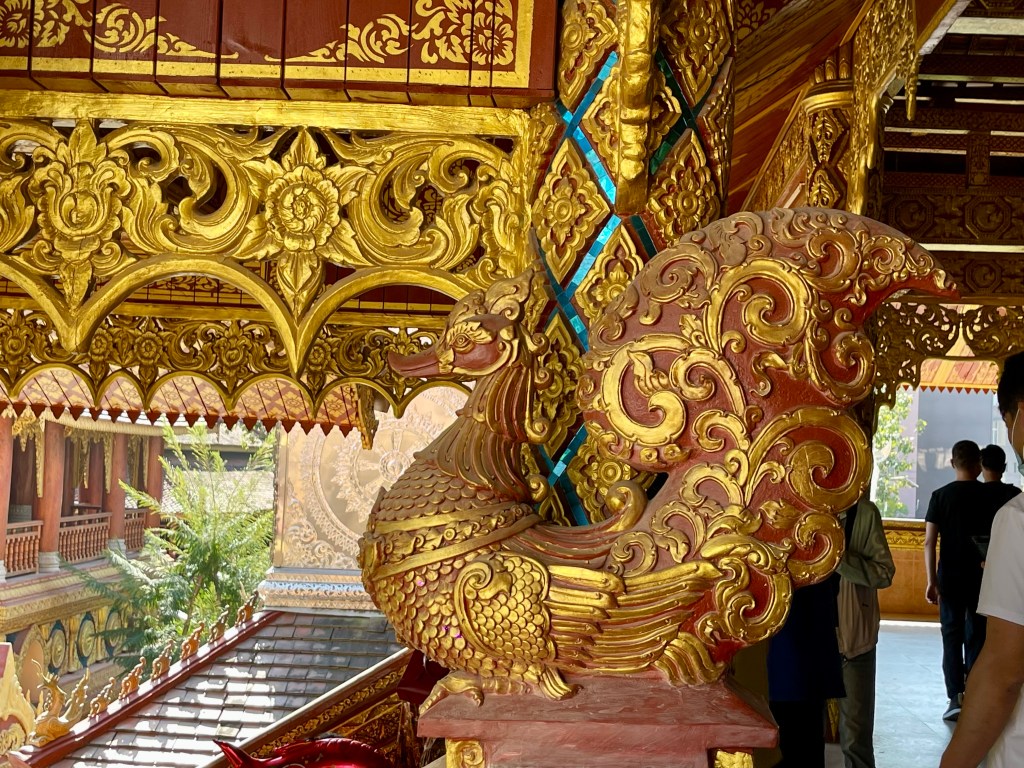
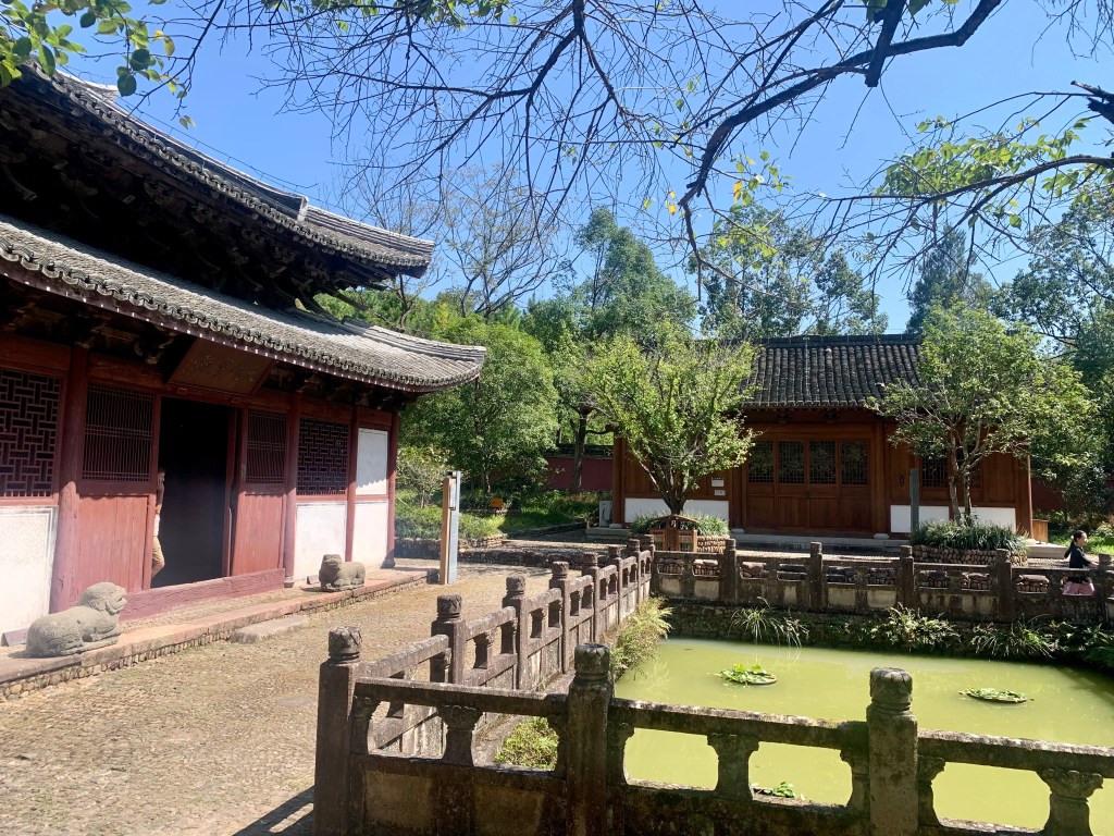
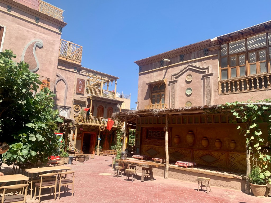
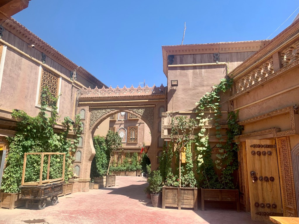
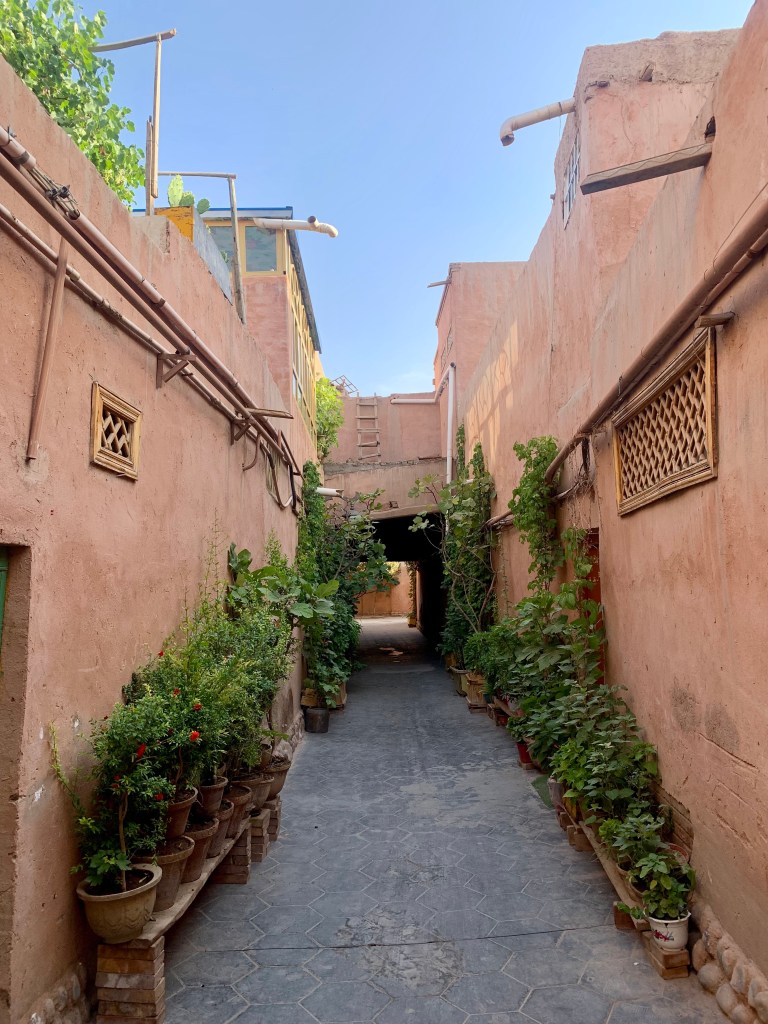
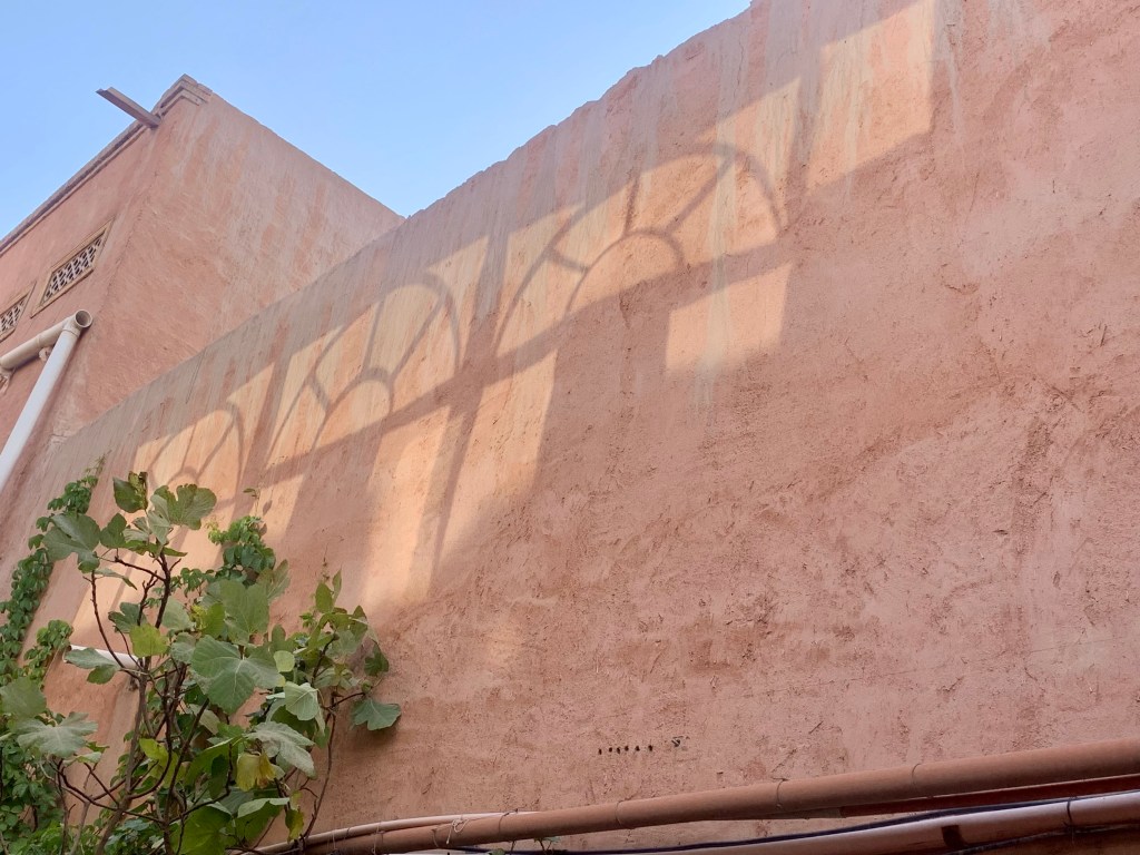
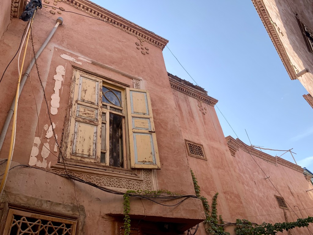
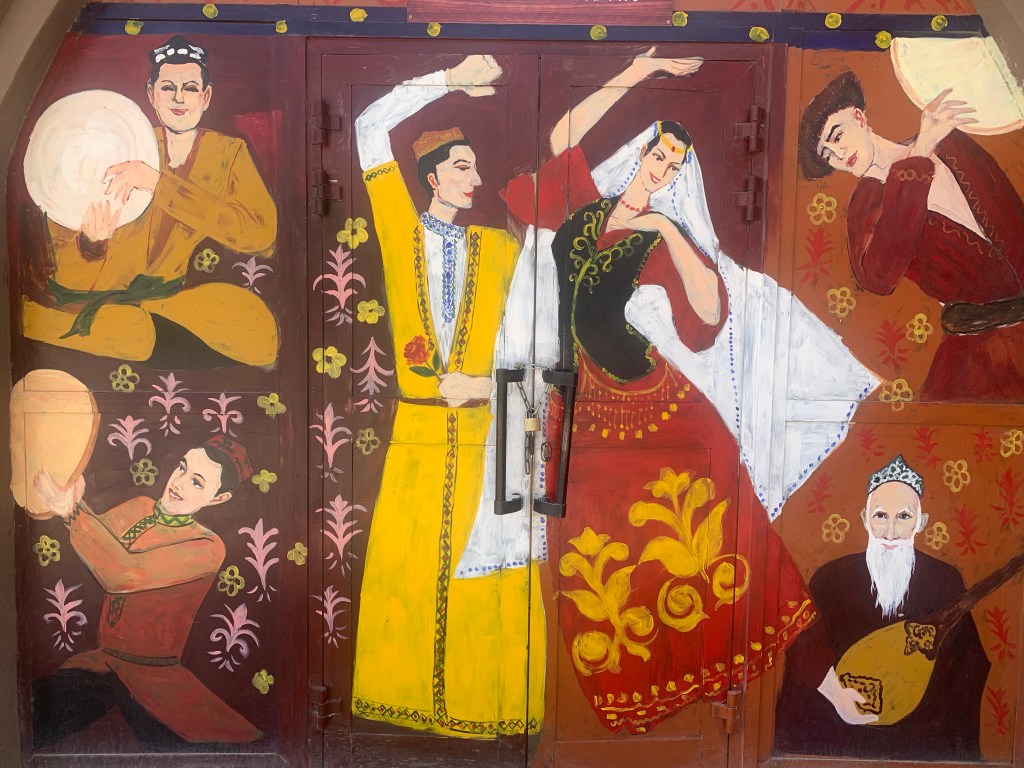
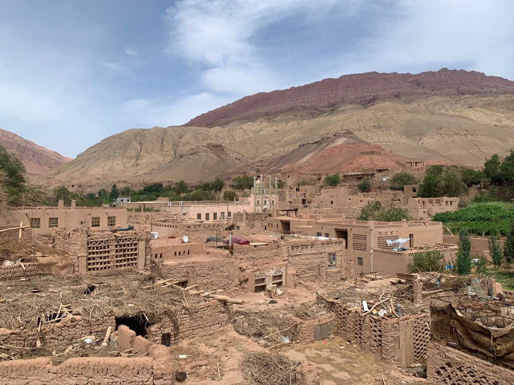
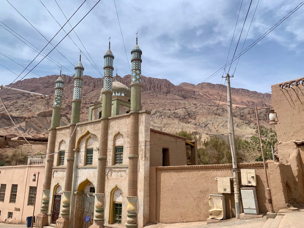
In China, there are 56 officially recognized ethnic groups. (This is why the idea of “Chinese” being a language is ridiculous. Mandarin is one language that is spoken throughout China; yes, since the 1930s it has been the “official” language of China that is taught in schools and heavily enforced, but there are so many Chinese languages and dialects that to claim any of them as being “Chinese” is silly. I have many more thoughts on the subject, but this – like many things – will be better suited for an off-line conversation.) Xishuangbanna is home to 14 different ethnic groups, one of which is the 布朗族 Bulang (or Blang) people. There are approximately 90,000 Bulang people in China, a majority of whom live in the 勐海镇 Menghai area of southwest Yunnan. (Geography reminder: Yunnan is a province within China, Xishuangbanna is a prefecture within Yunnan, Menghai is a county within Xishuangbanna.) Descended from the ancient 濮 Pu (or Lolo) people, the Bulang are considered to be one of the three indigenous peoples of southwestern Yunnan. As we had a local Bulang tour guide accompanying us on our trip, we were able to take a few hours to go and visit a Bulang village that welcomes tourists and provides a look into their customs, architecture, and handicrafts.

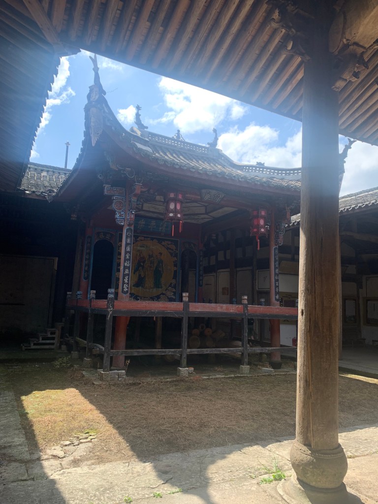
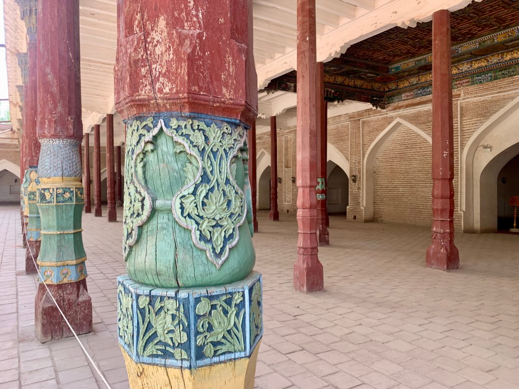
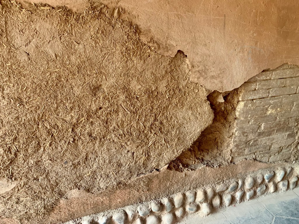
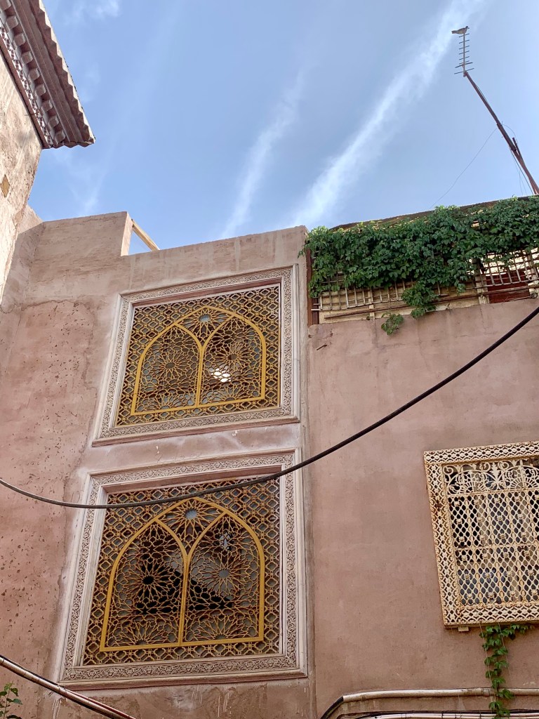
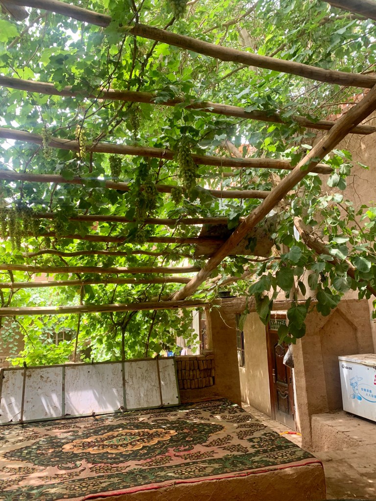
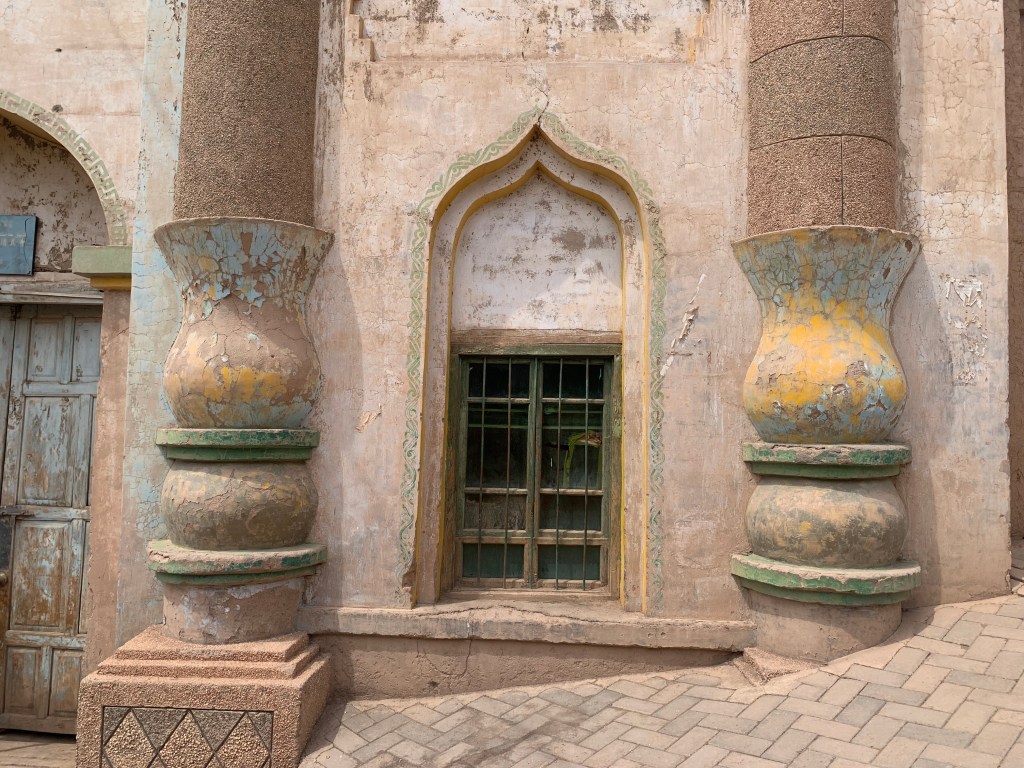
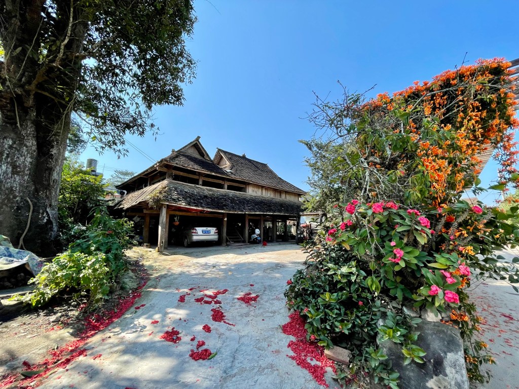
One of the interesting things our guide shared with us was the way in which houses are built. Traditional Bulang homes are wooden, two-story buildings; the first floor is an open space where domestic animals can be kept, and the second floor serves as the living quarters with a fireplace in the middle for cooking, heating, and light. When it comes time for a new home to be built, the entire village comes out to help. With everyone working together, the house is built in 2-3 days and blessed in a traditional ceremony.
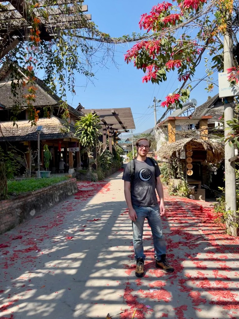
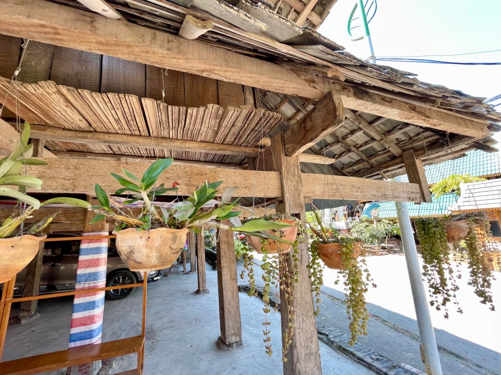
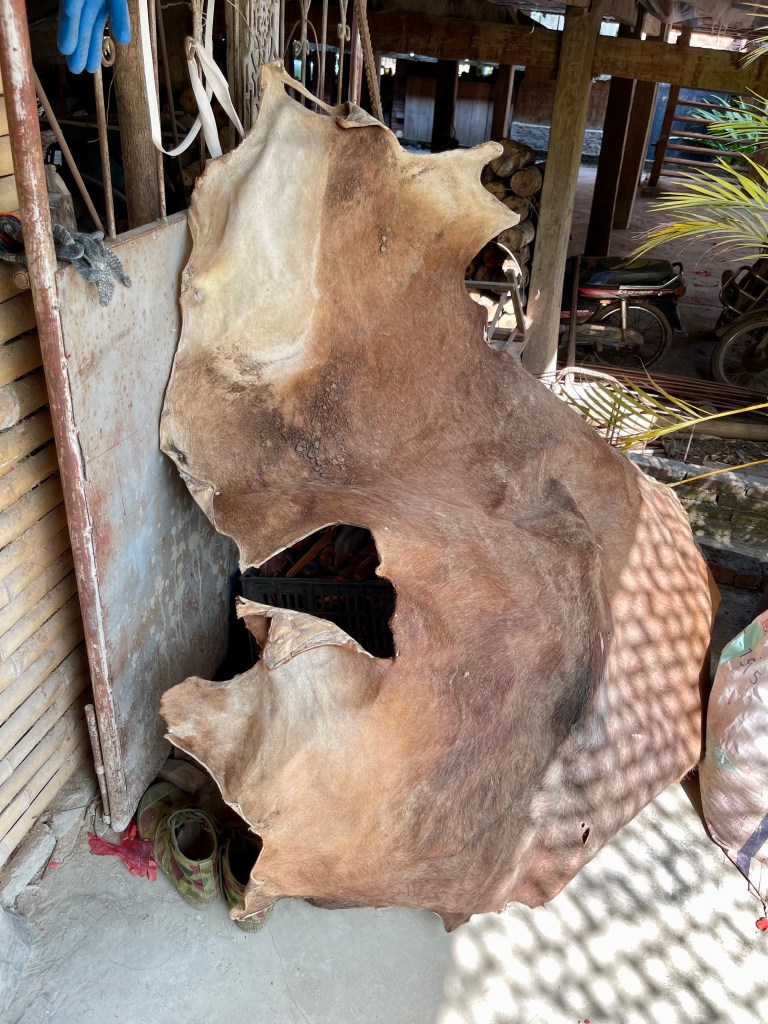
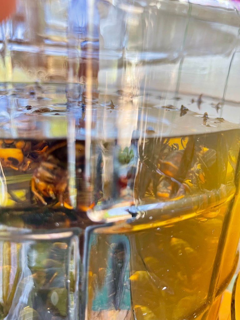
As we walked through the village, we were able to learn a lot about the culture just by observing. We passed a courtyard where an animal hide was being dried in the sun so it could be cleaned and stretched into a traditional drum. We also passed a small shop selling various flavors of 白酒 baijiu, which translates into “white liquor” and is a very strong, fermented, distilled sipper that is popular throughout China. Now, I’ve had baijiu before, it’s not something I’m particularly partial towards, but one of these jugs of baijiu caught our eye due to its flavor… bee! That’s right, floating around infusing the liquor were a bunch of bees! Well, you know what they say: when in China, drink as the Chinese drink… (It wasn’t that bad. Michael did say he thought it tasted like rat poison, but, honestly, that’s kind of just regular baijiu. You get used to it.)

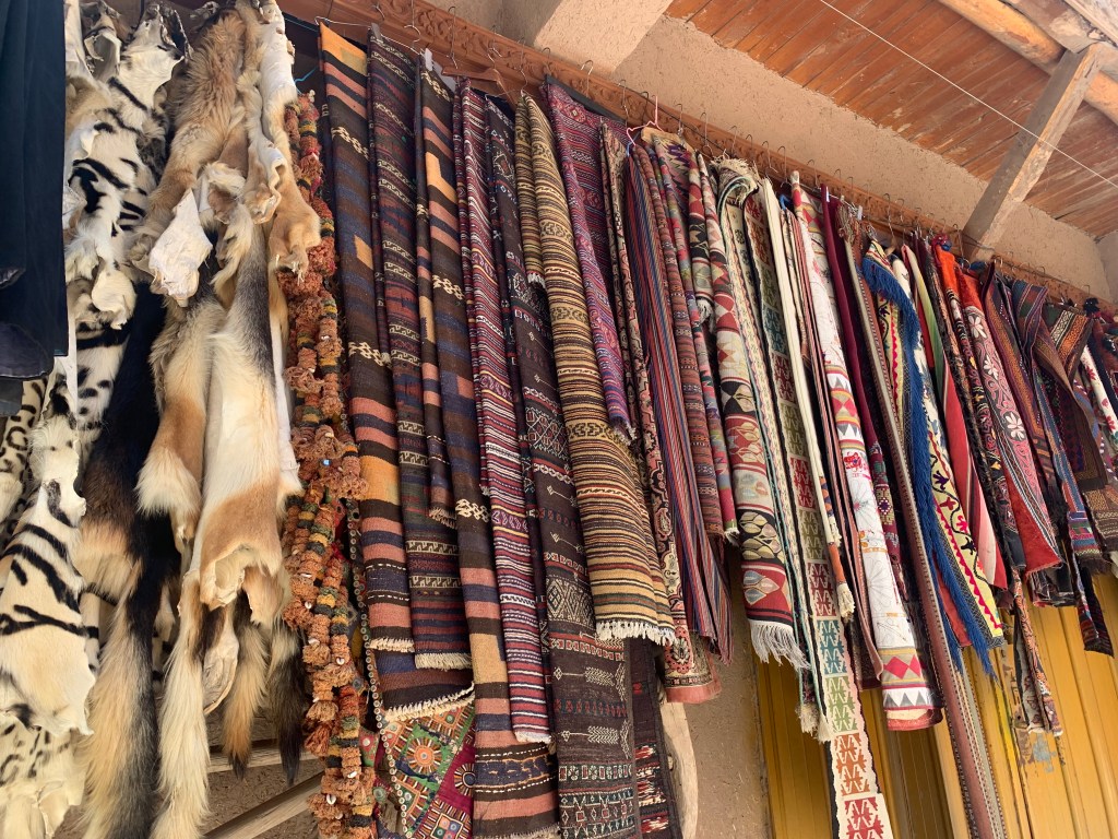
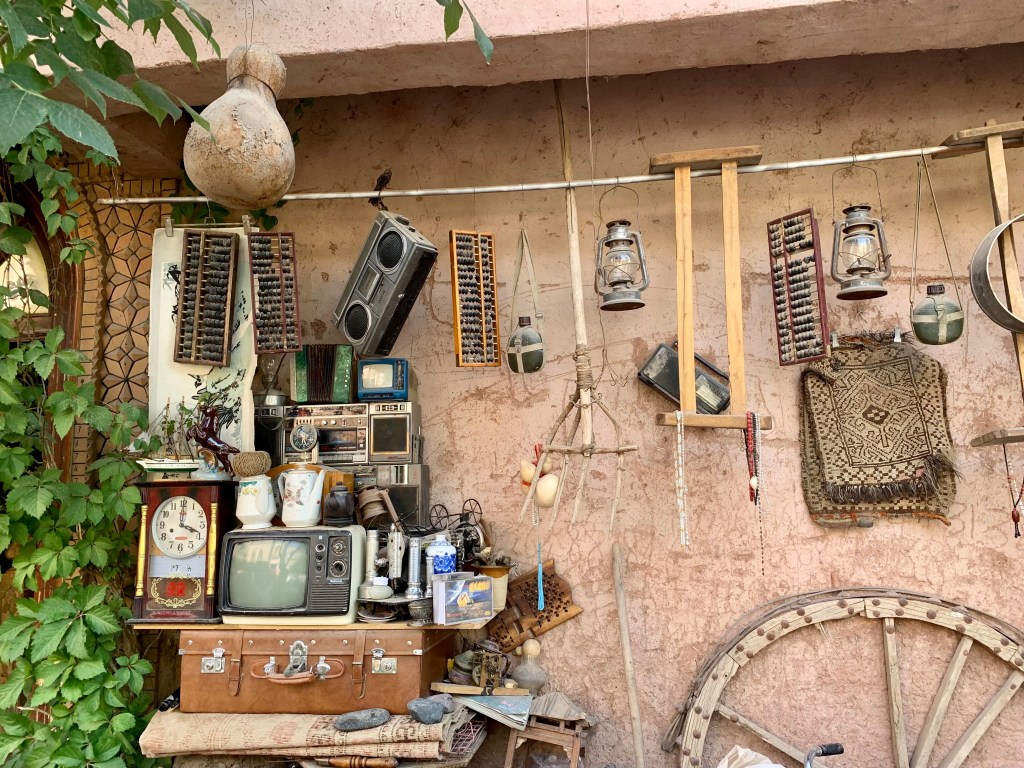
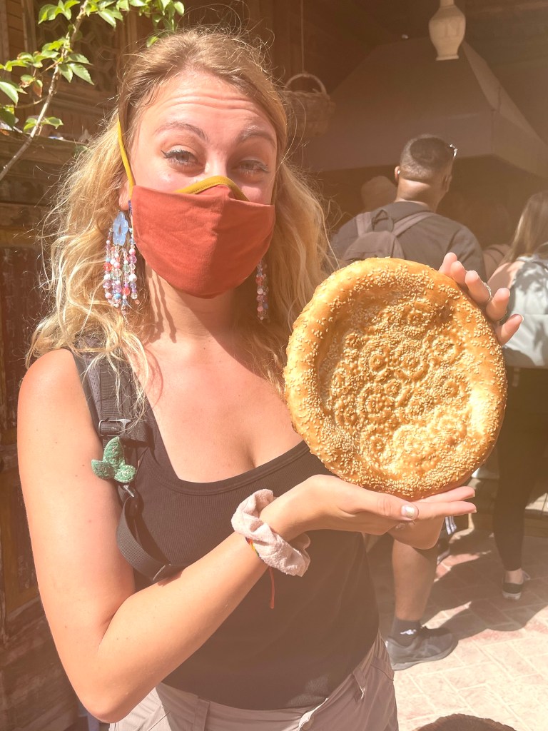
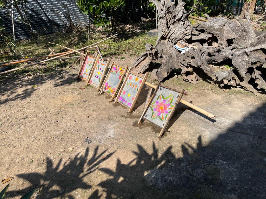
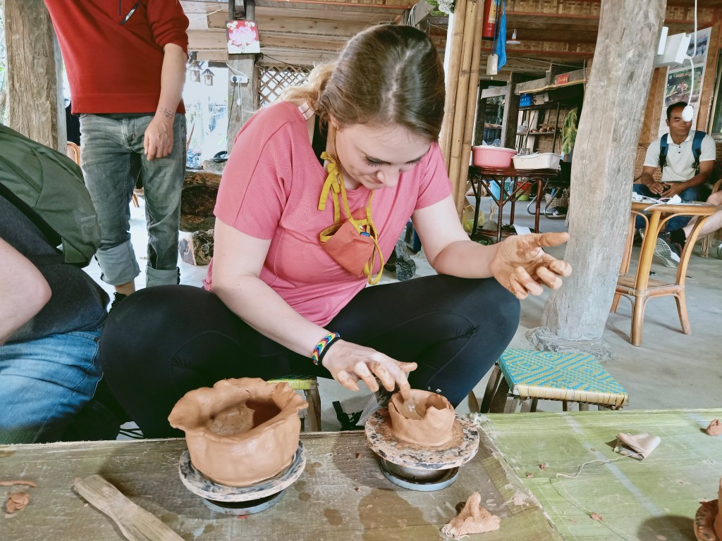
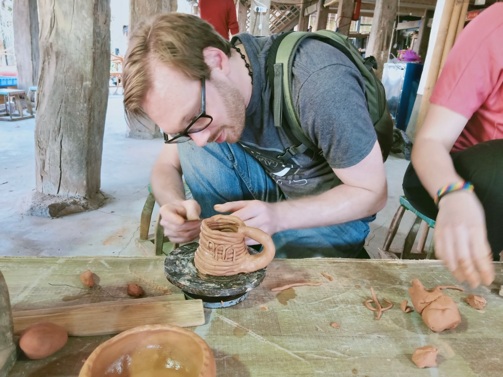
One of the aspects of this village visit that has been different from any other that I’ve done in China was that we got to enjoy some arts and crafts! After observing and learning about some of the traditional Bulang handicrafts, we were given the opportunity to make our own paper (pressing in some local flowers for decoration) and pottery pieces. Though this may not have been everyone’s cup of tea, I, of course, was absolutely delighted. I am ALWAYS down for an art project, especially one I can hang up in my house afterwards!

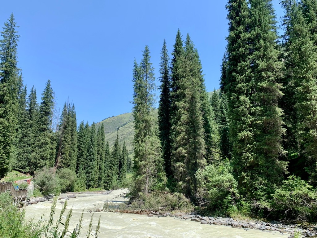
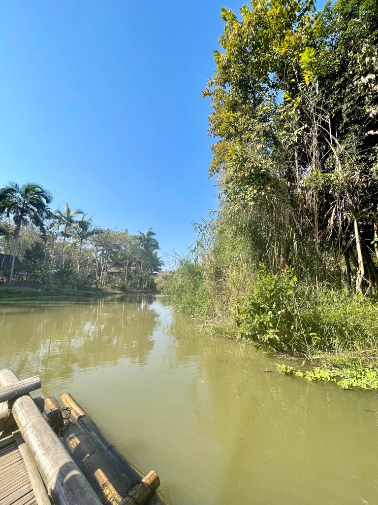
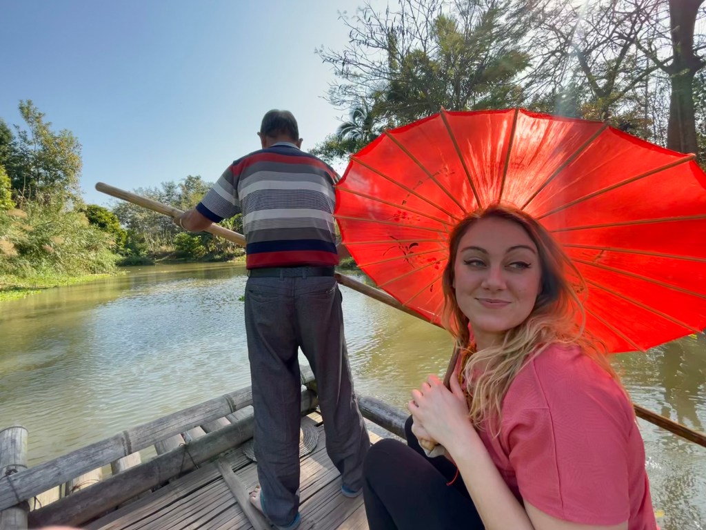
Next, we all climbed on to bamboo rafts for a peaceful ride down the river! Thankfully, we were given umbrellas for the ride – not only were they cute, but they helped shade us from the blaring sun in the heat of the day. Especially that far south (right near the Tropic of Cancer, about at the same latitude as Abu Dhabi, Mexico, Hawaii, and the Sahara Desert) sun protection is no joke!

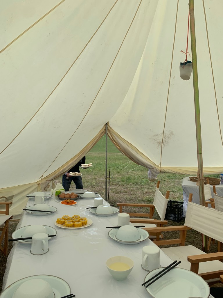
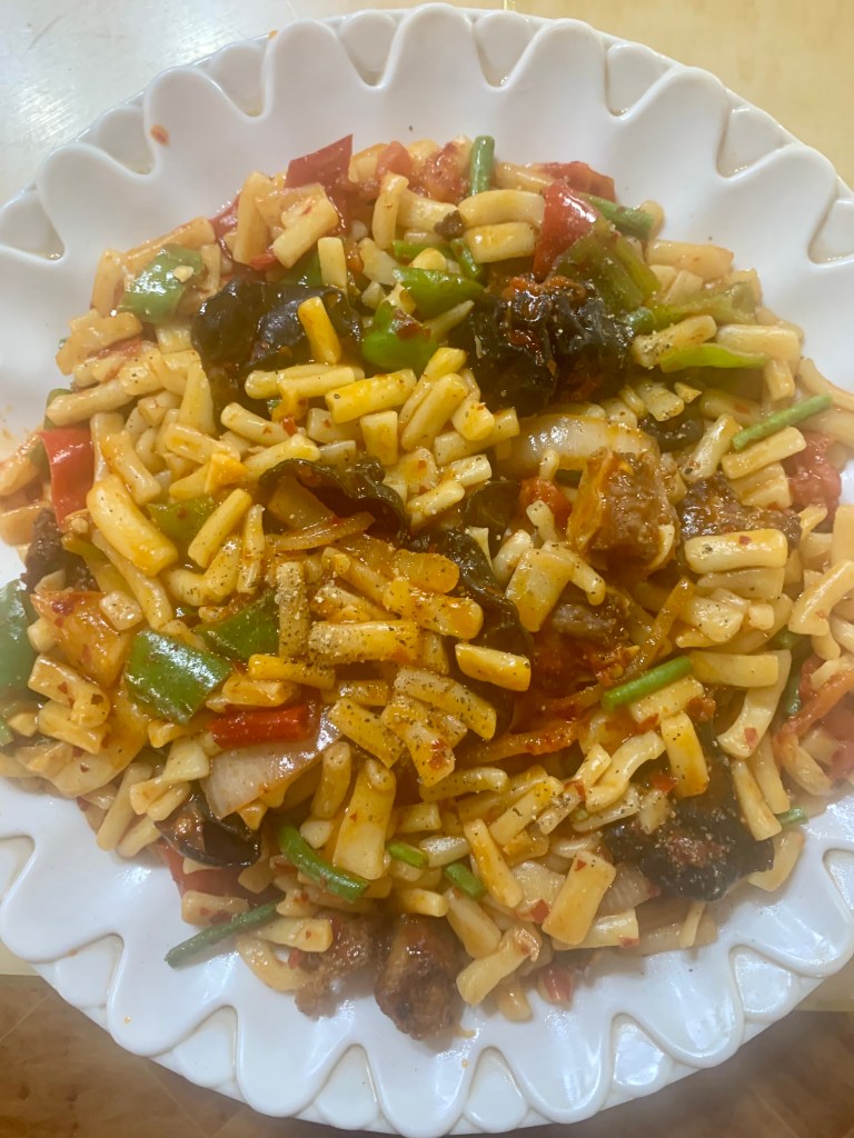
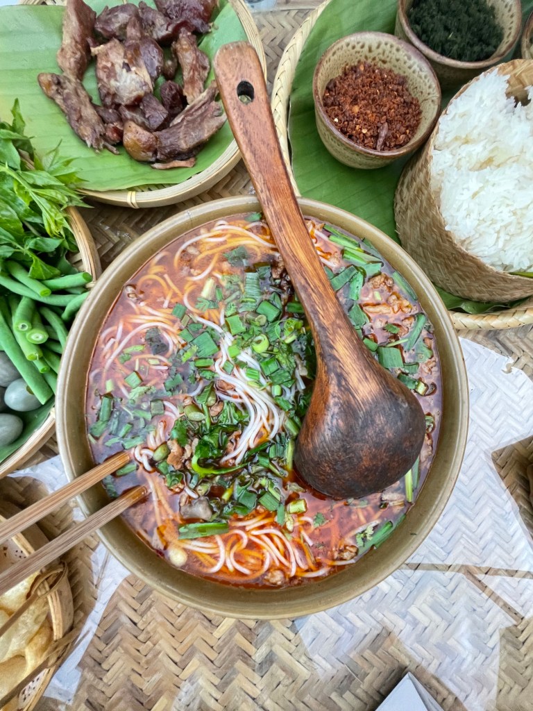
After an exciting day of exploring the Bulang village, we headed back into town and ate a delicious dinner full of Yunnan specialties. Being able to taste all of the different kinds of foods has been one of the most exciting (and, sometimes, challenging) parts of visiting so many different Chinese provinces. Exhausted from the day, after dinner Michael and I headed back to the hotel to get some rest before the next day’s adventures.

As I mentioned in my previous post, Xishuangbanna is known primarily for one delightful feature: elephants! As the only area of China where you can find wild Asian elephants, much care and attention has been put into their preservation and wellbeing. We spent our morning learning about and observing these fantastic creatures at the 野象谷公园 Wild Elephant Valley Nature Reserve. A small rescue and research center in the middle of a much larger nature reserve, Wild Elephant Valley hosts about 30 rescued elephants and plants tasty trees and plants for about 300 wild elephants who are free to roam the protected area as they choose. (This is where the herd of wandering elephants from the news a few years ago were from!)

Now, I will admit I was skeptical at first, as I would be about any animal park. I do not condone wild animals being held in captivity, and often abused, to “perform” for humans and I knew that many parks like this are guilty of that. When visiting Zimbabwe a few years ago, I went on an elephant-back safari which at the time felt really cool, but I do not think I could do in good conscience anymore. Though I initially found some information online about elephant performances at this park, from what I saw when I was there and the information my tour guide provided, I do not believe those performances are happening any more. All of the resident elephants at Wild Elephant Valley have been rescued, and they work to be able to release many of them back into the wild. Most of the park is just a protected area where wild elephants can roam freely, coming and going as they choose. There was a heavy emphasis on protecting and preserving these last wild elephants living in China; the park was primarily focused on education rather than a show-and-tell, or so it seemed to me. There are many tourist attractions in China that give me pause or make me skeptical (there’s a reason I haven’t been to the zoo…) but I felt good about Wild Elephant Valley after visiting. (I told Michael that if there was an elephant show I would pointedly refuse to attend. I am glad I didn’t have to.)

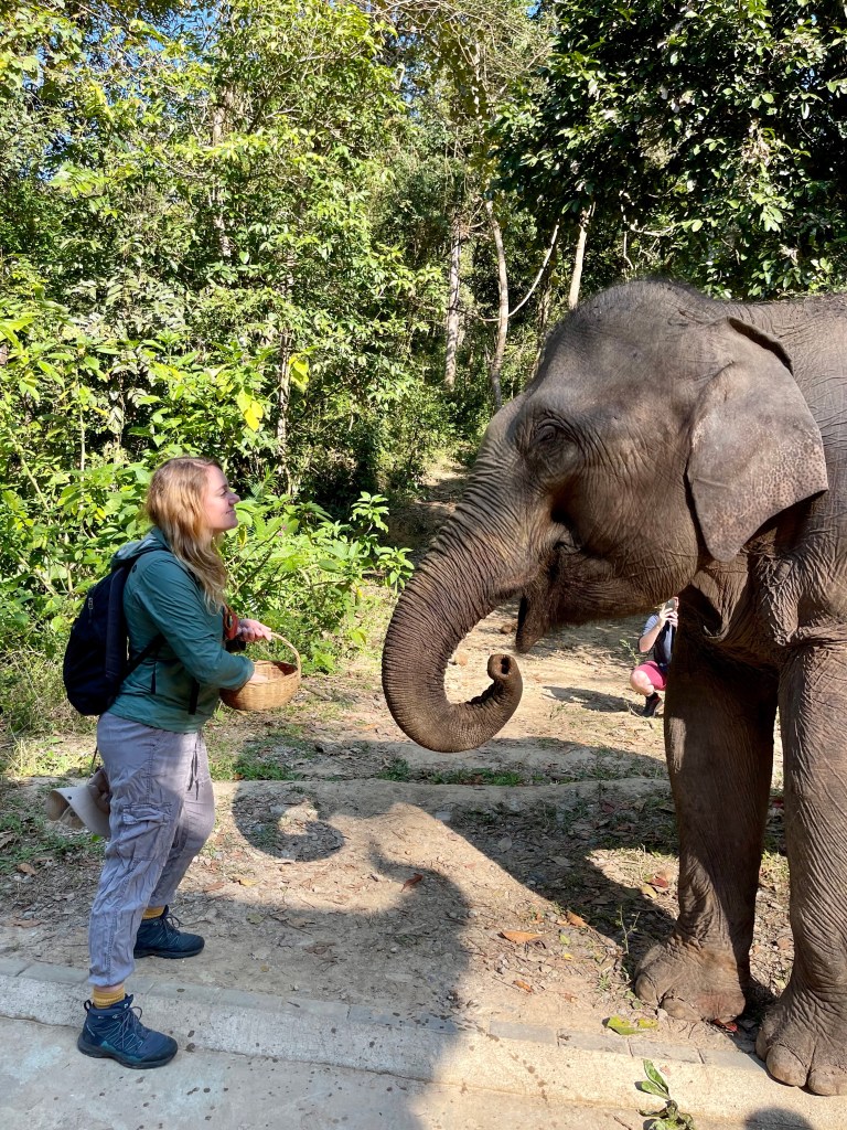
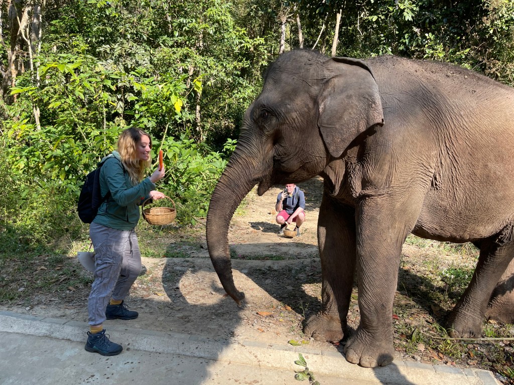
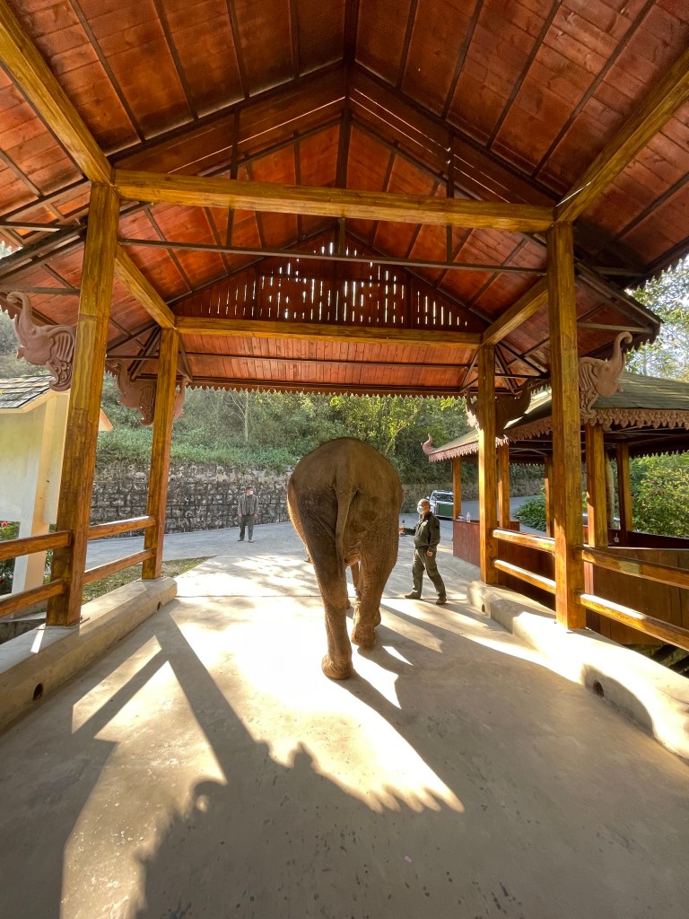
When we first arrived, our tour guide was able to arrange a special encounter for us with Ma Li, this sweet and silly 30-year-old rescue. We were able to follow along with her caretakers as they went on one of her daily walks through the rainforest. We were instructed to keep a safe distance during the walk, and eventually we stopped in a clearing and were given a chance to feed her some carrots. Though I’d interacted with African elephants before in Zimbabwe (and I’m pretty sure I saw some in a circus when I was younger, yikes) there is truly nothing like sharing a moment with these incredible creatures – it never gets old. Though I kept my distance with the intention of keeping her as comfortable and safe as possible, Ma Li was not shy at all — she came right up for snacks and head scratches. And oh boy was she excited about those carrots!

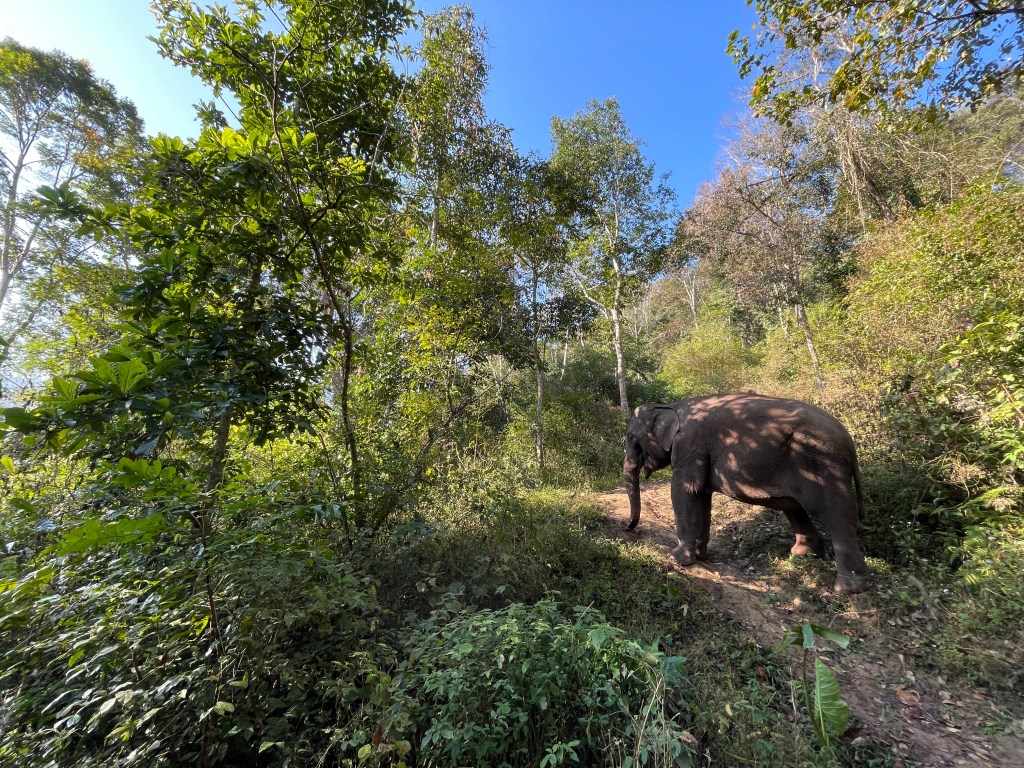
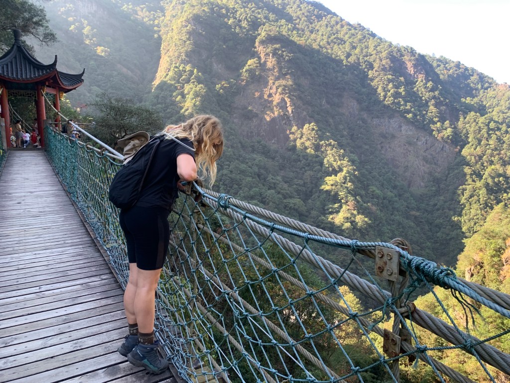
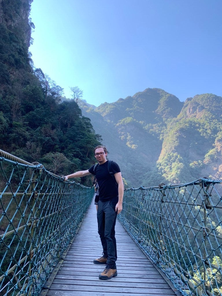
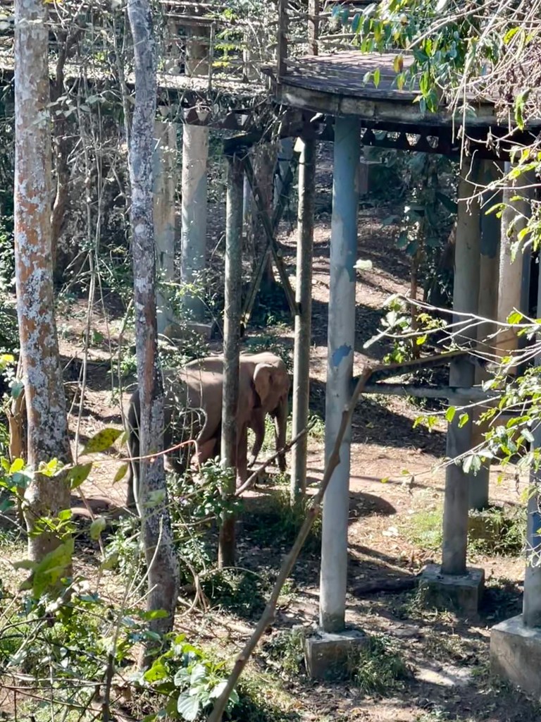
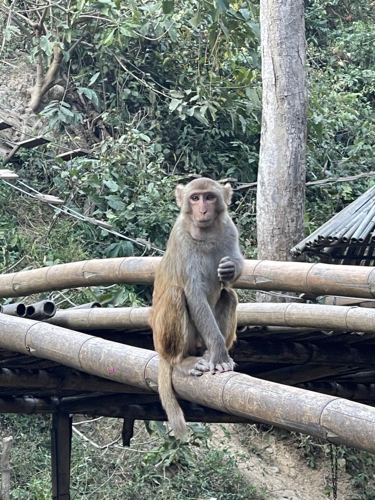
After our private encounter, we went back to the main part of the park to tour the Asian Elephant Museum and explore the Elephant Observation Elevated Walkway. The elevated walkway is 2,280 meters long, allowing guest to walk high above the park, hoping to get a glimpse of some of the wild elephants as they wander through the forest. We were quite lucky — we ended up seeing 7 wild elephants as we walked! (Plus a few VERY cute monkeys.)

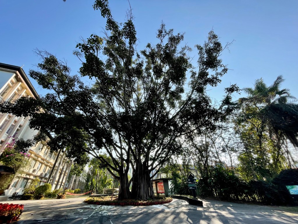
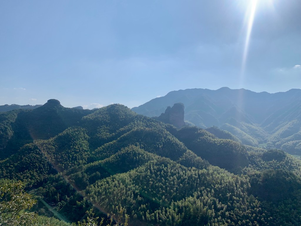
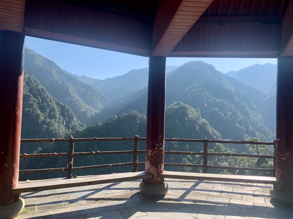
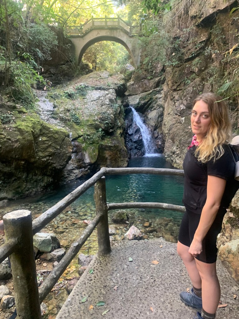
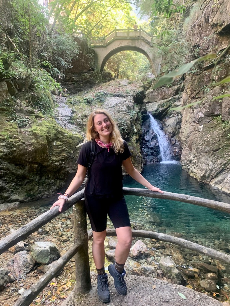
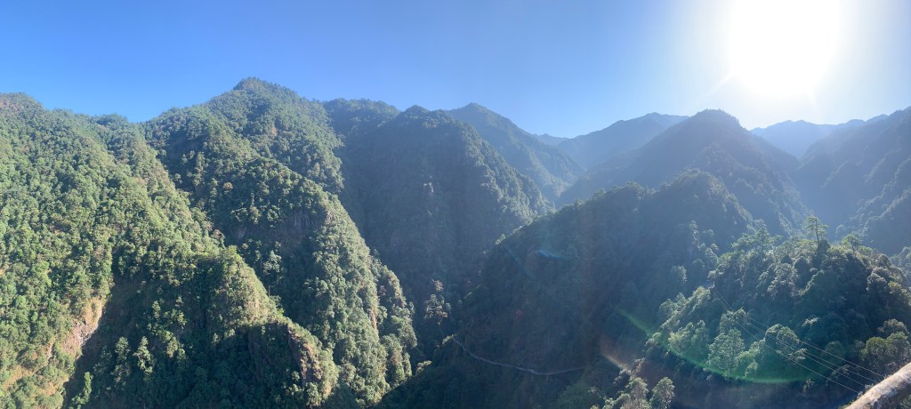
After leaving the Wild Elephant Valley, we drove over to the 西双版纳原始森林公园 Xishuangbanna Primitive Forest Park. Also known as the Primeval or Virgin Forest Park, the Primitive Forest Park covers an area of over 16.5 square kilometers, 98% of which is covered by trees, and has been named by the Chinese National Geography magazine as one of China’s top ten most beautiful forests.

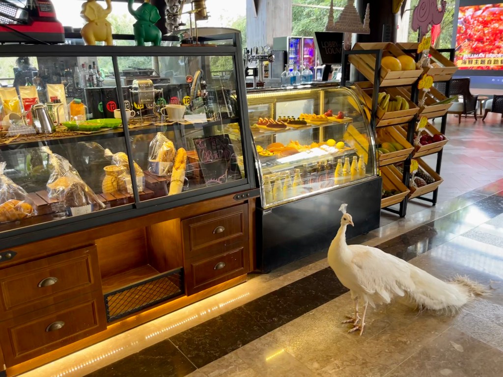
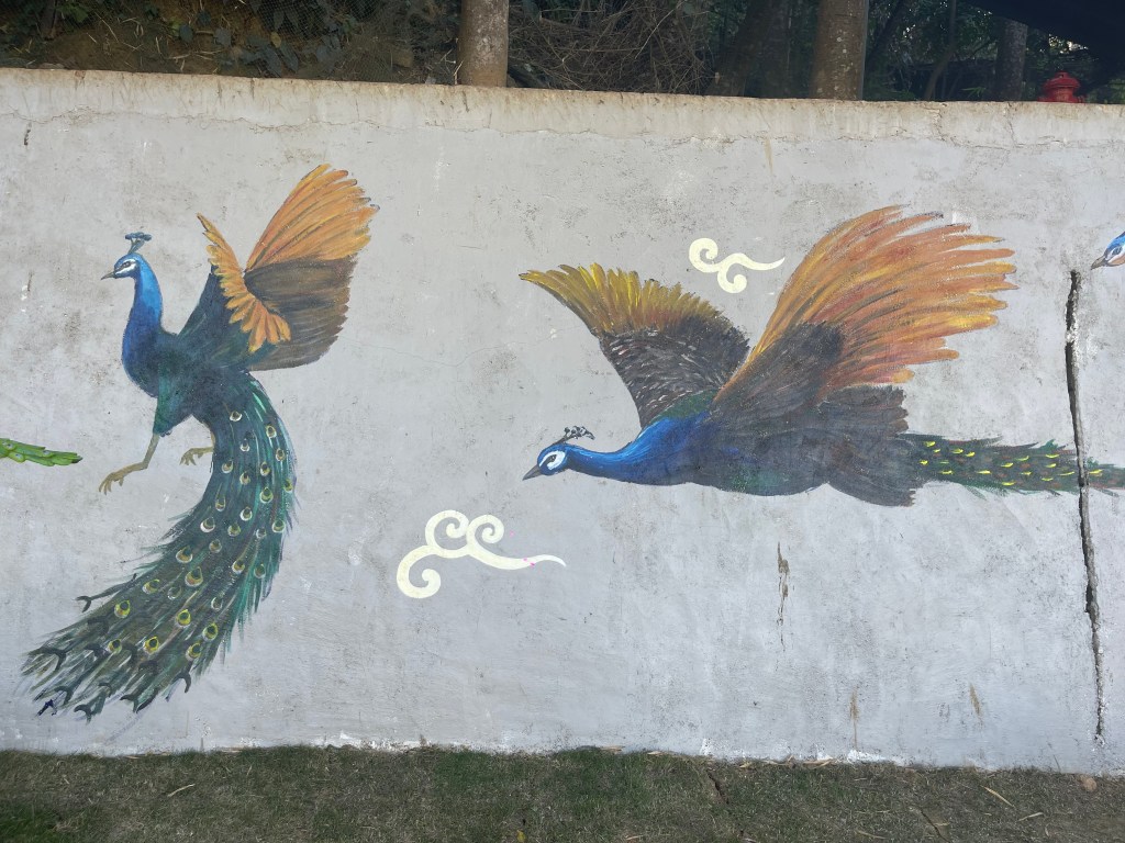
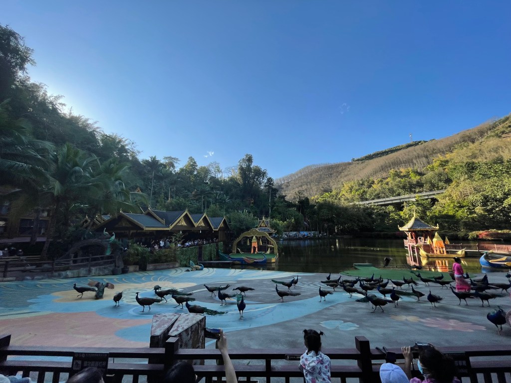
While there, we made our way to the outdoor theatre to see the Legend Between Prince and Peacock Princess show followed by the Flight of the Thousand Peacocks. (Is it even a Chinese tourist site if there isn’t a romantic dance show about a prince falling in love with a magical fairy animal that turns out to be a beautiful princess?) After the brief performance, one thousand peacocks (or so they say) are released from up in the hill; they then fly down over the lake and land just in front of the audience where they can be fed and taken pictures with. Also: yeah. Peacocks can fly. Which I guess I probably knew, but, still.

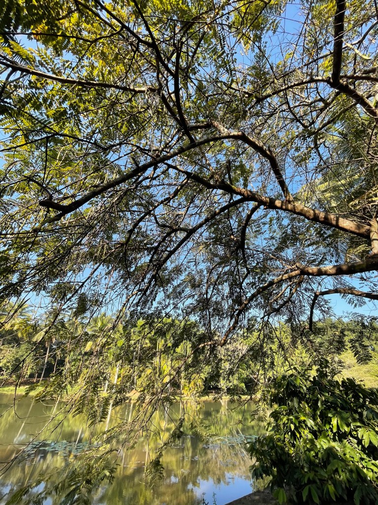
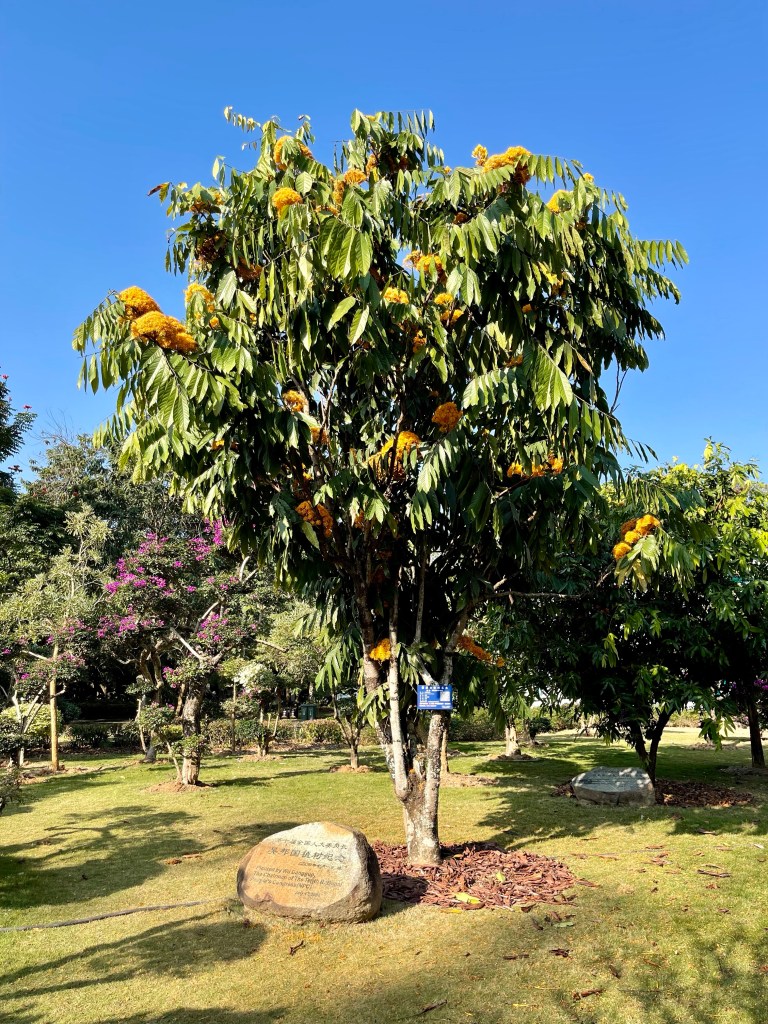
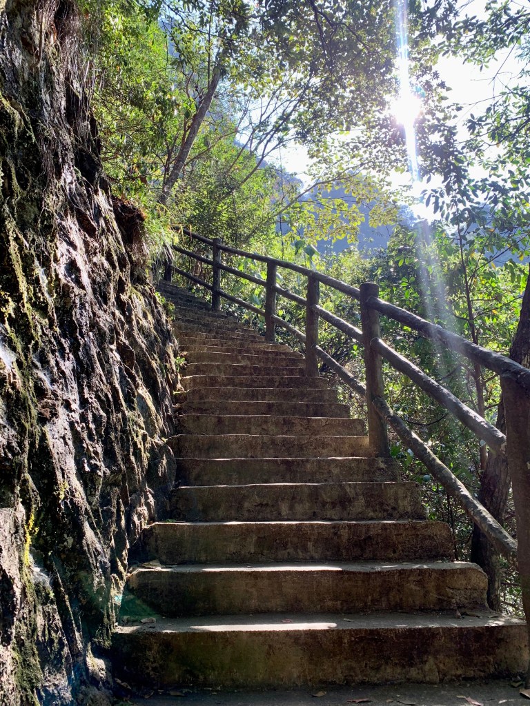
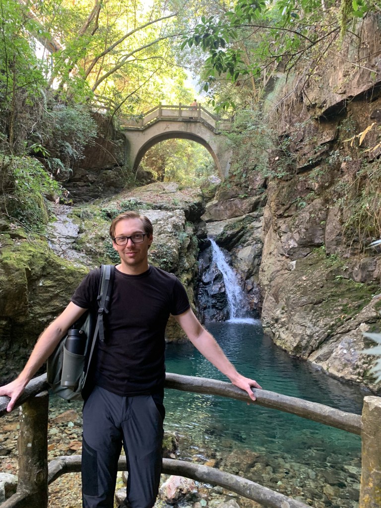
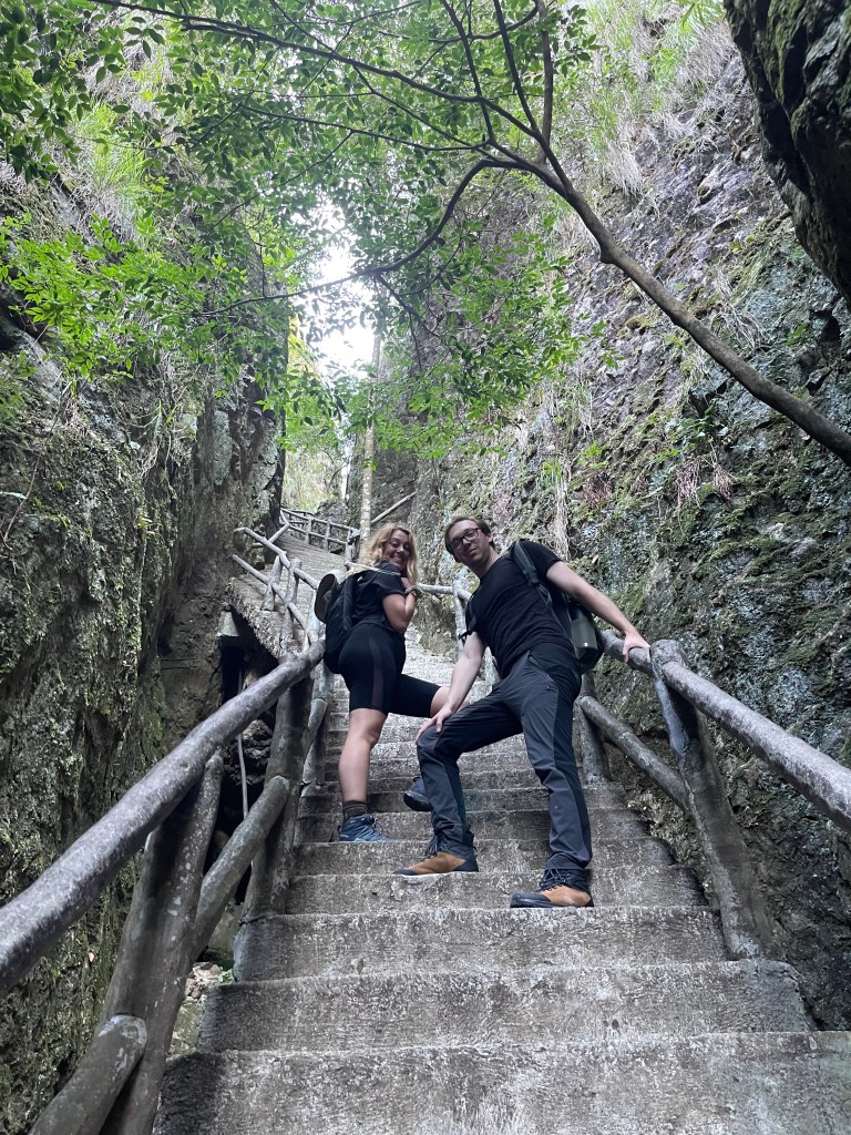
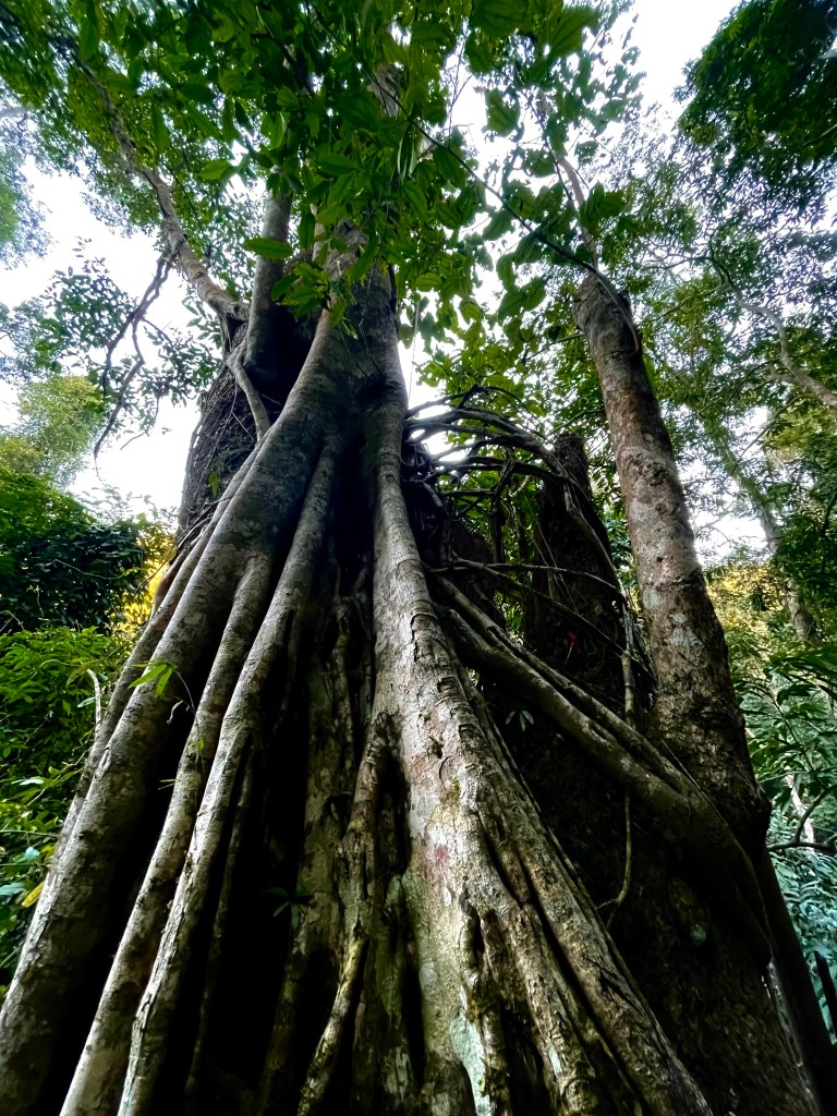
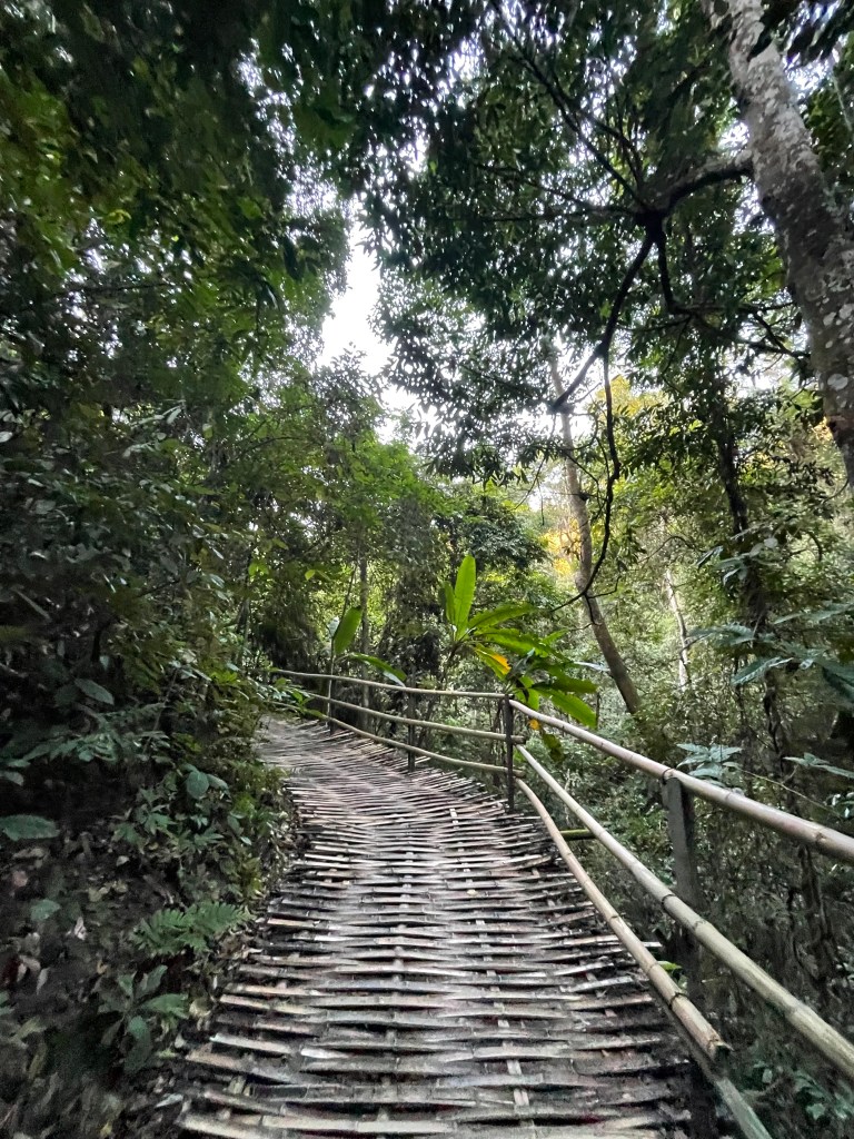
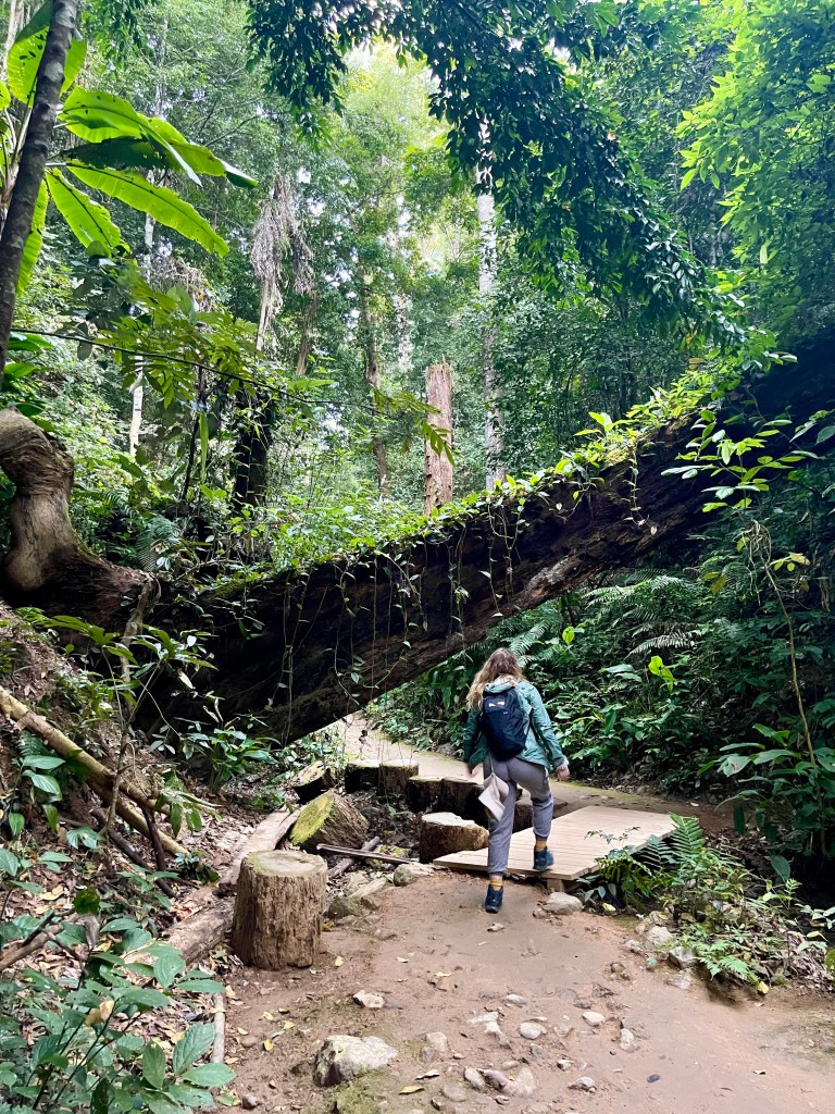
After the peacock show, we headed up into the rainforest proper for some hiking and exploring. This was my favorite part of the park. (We have yet to get to Michael’s favorite part… I’ll let you know.) We were able to walk through paths that took us up and gave us a better view of some of the incredible trees and plants growing here. Oh yeah, and there were trees that have been classified as dinosaur era living fossils. DINOSAUR TREES, I REPEAT, DINOSAUR TREES.

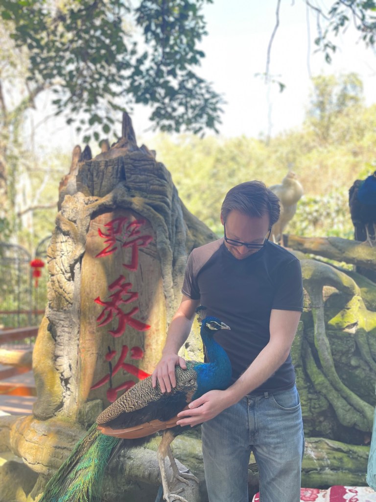
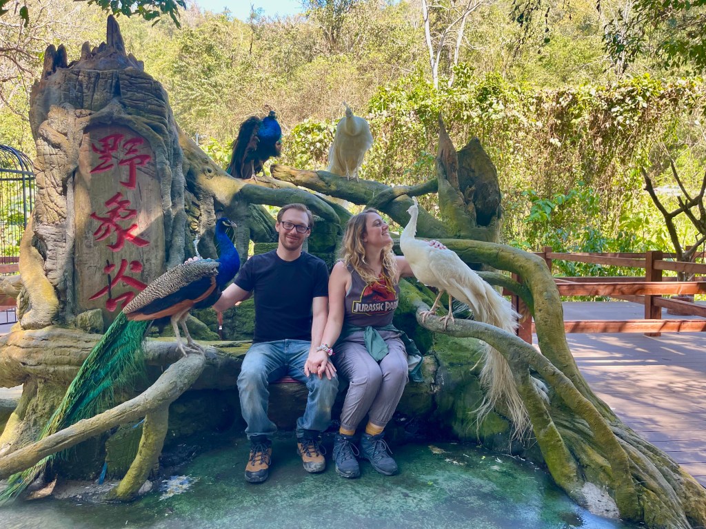
And then, as we were nearing the end of the park, there was an area for a peacock photo opportunity, because, well, China. Everything needs a photo op. So we obviously paid the 20 kuài to go hang out with peacocks. Come on, now. (And yes, THIS was Michael’s favorite part. Just look at his prom picture with that peacock. Pure joy.)

The Von Peacock Family Singers

As always, thanks for reading along. I know I am notoriously bad at keeping any kind of a consistent posting schedule and regularly am at least 6 months behind in writing about my travels, so it means a lot to know that there are people following along and wondering what I’m up to. If you ever have any questions, or want to hear more about something, please feel free to reach out – I would love to hear from you. Until next time!

Xishuangbanna: The Land of Peacocks and Elephants

Where last I left you, we had just traveled to Wuyi and Gouqi Island in the Zhejiang province for Golden Week – the first week in October. Due to heightened pandemic concerns (are you sensing a theme here?) we were not able to leave Shanghai over any of the next few holidays but, contrary to my and many other expats’ belief, life still goes on even when you can’t travel. So, before I fast-forward to my next big trip, a quick recap of life in Shanghai from October through January. Lots of holidays — dressed up as some Loki variants for Halloween, made our first Thanksgiving turkey when I hosted Friendsgiving (it took nearly 10 hours to cook but it was honestly perfect, we may be holiday master chefs), had people over for latkes (traditional and vegan!) for Hanukkah, ALL of the Christmas traditions both here and virtually with family, and various other adventures in this cool city we call home.

What’s great about living in China (and teaching at a school that acknowledges both international and Chinese holidays) is that only a few weeks after getting some time off for Christmas/New Years, we get a two full weeks of holiday for Chinese New Year. Though there was still some risk involved with traveling — the pandemic continues to make things complicated over here — we decided to take the chance and go out for a weeklong adventure somewhere. (And OH BOY am I glad we traveled while we still could. But more on that in a blog to come…) We packed up our backpacks and hopped on a plane down south to… Xishuangbanna.

᧑᧒ ᦗᧃ ᦓᦱ ᩈᩥ᩠ᨷᩈᩬᨦᨻᩢ᩠ᨶᨶᩣ Xīshuāngbannà 西双版纳 can be found on the very southern edge of the 云南 Yunnan province, near the borders to Myanmar, Laos, Thailand, and Vietnam. Often referenced as the “Thailand of China,” Xishuangbanna (pronounced “tsih-shuang-bah-NAH,” sort of…) is the home of China’s Dai ethnic minority and is known for its lush rainforests, tropical fruits, and wildlife. Xishuangbanna is especially famous for its peacocks and elephants; in fact, this is the only place where wild Asian elephants can be found anywhere in China – you may have even heard of them before! Remember in March of 2020 when a herd of elephants decided to try out the nomad life and wandered around for 17 months, marching through villages and munching on people’s farms, before finally heading home? They’re from here!!

Xishuangbanna is much more similar to Southeast Asia than it is to the rest of the country, so it is a really fun way to experience something new while living in China – especially when you’re not able to leave the country! Michael and I were excited to head down south and discover a culture completely different to the one we’re living in. When we were greeted by peacocks upon checking in to our (gorgeous!!) hotel in 景洪 Jinghong (the capital of Xishuangbanna), we knew we were in for an amazing week.

After checking out our BEAUTIFUL hotel (seriously, like, it felt like we were on a honeymoon) we headed out that evening to the 星光夜市 Starlight Night Market. Located just behind the 大金塔 Dajin Pagoda (Big Golden Pagoda), the market is full of rows and rows of small stands selling food and gifts; though there are other night markets in the area, Starlight is the most popular – and for good reason. Just look at it!

As we wandered up and down the little streets and alleyways, it was fun to see all of the various gifts and souvenirs being sold. Jewelry, bags, clothing, textiles, small figurines… My favorite part of it all was seeing the styles and flavors from the local minorities; there were all sorts of traditional dresses and costumes available for you to pay to dress up in and get a picture taken. I love the beautiful colors and textures on the dresses!

Now, no post about the Starlight Night Market would be complete without mentioning one of the most prominent parts of the market: the street food! Featuring an assortment of dishes and treats, the night market was an ideal place for walking around and taste-testing our way through the local cuisine. While, I will admit, there were a few snacks that I just couldn’t work myself up to this time around (the pig tails were… a lot…), we had fun walking up to booths and randomly pointing to things that looked tasty! (And not as tasty. Check out the video below to see the moment that Michael learned roasted durian may be his least favorite food. We just saw other people lining up for something, assumed it must be good, and got in line as well. Ah, well.)

Michael would like me to share that he meant to say tauntaun instead of wampa. He knows better, but the durian got the best of him. Please forgive him.

With all of the colors, the sounds, the smells, and the tastes, the Starlight Night Market was a vivid introduction to the culture of Xishuangbanna and a magical way to spend our first night.

The next morning, we made our way out to the Xishuangbanna Tropical Flowers and Plants Garden. Originally used as an experimental field for research into various tropical crops, the garden was opened to the public in 1999 and features over 1,000 species of trees, palms, aquatic plants, flowers, herbs, and fruits.

As we walked through the park, our guide was able to stop by certain trees or plants and tell us more information about how they grow, what they are used for, etc. That may not be all that exciting to everyone, but I found it fascinating!

After enjoying the beauty of the plants and flowers all morning, it was time to move on to the beauty of the statues and architecture of the 总佛寺 Zongfo Temple.

Originally built in the year 615 by two monks from Burma, Zongfo is the oldest and grandest Buddhist temple in Xishuangbanna. Legend has it that when the temple was first being built, the local people wanted to build Buddha statues out of diverse materials and discovered there had been no bamboo statue made. Their most skilled craftsmen worked to weave and form the bamboo statue, but they could not seem to capture the mercy and kindness of the Buddha in his face. One night, an old man passing through claimed he could finish the statue’s head as they desired; doubtful, they left him to his work. The next morning, they awoke to find the statue had been completed exactly as they had hoped – many believed that it was the Buddha who made their wishes come true. (Not allowed to take pictures inside of the temple, but can confirm: the bamboo statue was beautiful.)

Though we’d only been in Xishuangbanna for a day, I’d already been completely overwhelmed by the beauty of the culture and just how different it was from anything else I’d seen in China thus far. And we hadn’t even made it out to the rainforest yet… Stay tuned!

Because if there is a gong, you hit the gong…

Gouqi Island: China’s Little Greece

Living in Shanghai, sometimes it is easy to forget that we are so near to the ocean. (Shanghai is most definitely not a beach city… though we do have palm trees!) Luckily, being this close to the coast, there are a variety of islands only a few hours away!

After one night to rest up and repack, we headed back down to the Zhejiang province — this time, rather than going in further on the mainland, we took a bus southeast to the 沈家湾 Shenjiawan Passenger Transport Terminal, where we purchased ferry tickets. Luckily, we had assigned seats on the ferry so once aboard we were able to settle in for the ride. (This was not a small little ferry boat. This was a hundreds-of-people-at-a-time, cars-parked-on-the-lower-deck, multi-tiered ferry boat. Not having assigned seats would have been a mad dash to find somewhere to sit.) After 2 hours, the ferry reached its first stop – an island where many of the passengers got off. After another two hours of walking around the deck and enjoying the sunshine (Michael immediately burned…), we reached our stop: 枸杞岛 Gouqi Island.

Gouqi Island is one of the most well known of the 泗列岛 Shengsi Islands, a group of about 400 islands that make up the Zhoushan Archipelago. Of the 400, only 18 of the islands are habitable. Deriving its name from the gouqi, or, goji berries (wolfberries!) that are found in abundance during the late summer, Gouqi Island is sometimes referred to as the “Little Greece of China” and is a popular tourist getaway. With a reputation as a fishing island, Gouqi is especially known for its mussel farms. (I’m warning you now, there will be a LOT of seafood pictures in this blog. So, depending on how you feel about seafood: you’re welcome, or, alternatively, I’m sorry.)

Unlike many of the other trips I’ve been on, this was more of a “here, welcome to a cool place, walk around and have fun” rather than a trip that follows a planned itinerary. We were brought to a small hotel (or, bed and breakfast? Bed and dinner? The owner of the hotel had her kitchen just underneath it, and she would cook us breakfast and dinner each day…) where we dropped off our things, then headed out to walk around the island and see what we could find. We were staying in 大王村 Dawang Village, which is the primary tourist area of the island, so within 15 minutes we found ourselves with a view of the beach. (Note: this is not really a swimming beach. It’s an “oh look, there’s some water” beach, but… I was never tempted to try and put on a swimsuit.) There is one main street facing the beach where basically all of the restaurants are, each with people standing out front trying to get your attention to go and sit at one of their tables. Michael and I are notoriously indecisive when it comes to restaurant decisions, so, luckily, a woman from one of the restaurants came over and gently dragged us to a table outside of her place. Problem solved!

Now, I am not the biggest seafood fan. In fact, I generally avoid it in my normal life, both for environmental reasons and because I don’t especially enjoy it, but: when traveling, I’ll try anything once. (And Michael will eat whatever’s leftover. It works out well for us.)

That evening, our group walked out to Xiyang Bay to see the sunset – a very popular thing to do on Gouqi. As we walked, it was cool to see all of the mussel farms dotted out in their grids in the bay. When we reached the viewing point, nearly an hour before sunset, it was nearly packed already. It seemed everyone on the island was coming out for the view. There was a marigold-colored wall with a staircase that everyone and their mother were stopping to take pictures on, but I didn’t feel like waiting around in line for a picture in front of a wall, so you’ll just have to imagine the influencer version of me in front of a yellow wall.

Rather than dawdle around until the last minute, Michael and I scoped out the various viewing points and eventually found some prime real estate — a temporarily empty bench. We sat until things started filling up around us, and eventually stood up on top of the bench so we could see without being pushed. Sometimes, in China, you need to play by Bear Rules — make yourself as big as possible. We widened our stances, trying to claim the bench as our own, but we still got pushed to the corner in the far edge by 3 more people who climbed up as soon as there was room that hadn’t been there when we were sitting. Ah well. All things considered, it was a truly gorgeous sunset.

After discovering our group had already left without us to walk back to the hotel (womp womp), we managed to navigate our way back just in time for the home-cooked dinner provided by the owner of the hotel. All seafood, all day. (Michael was delighted. I… made due.)

The next day, we took a trip over to 嵊山 Shengshan Island (connected to Gouqi Island by a bridge!) to see what is probably the biggest tourist attraction: the abandoned “ghost village” of 后头湾 Houtouwan. Once a thriving fishing village, this “miniature Taiwan” was home to more than 3,000 people at its peak in the 1980s. But now, ivy climbs up the walls and through the windows of the empty buildings, nature slowly taking over the village and making everything feel otherworldly. So, what happened to Houtouwan?

Well, it’s not nearly as dramatic as it could have been. No mysterious illness or true crime mystery, just… life. The fishing ports became too crowded, living area grew limited, difficulties getting food delivered, lack of access to good education, etc. In the early 1990s, the residents of Houtouwan packed up and left, moving either to another area of the islands or to nearby Ningbo or Shanghai. By 2002, the village was completely abandoned.

Then Mama Nature proceeded to do her thing, and now Houtouwan is known as the “green ghost village” due to all of the plants that have begun growing over, under, around, and though the abandoned buildings. The effect is eerily beautiful.

Walking through the stone pathways, it’s a very strange experience. I’ve seen “ghost cities” before, but never so modern. These are not the faded stone walls from ancient civilizations; looking into the houses we can see bathtubs, bed frames, faded posters on the walls. These homes have been empty only as long as I’ve been alive. It’s a weird but cool experience.

Exploring Houtouwan, there are very clear paths for you to walk on, and a few where you can’t get through because of the plants growing there. A few buildings are open for you to peep into, but by and large most of the houses are off-limits if there is not a guarantee that they are structurally sound. Makes sense. I may have feigned ignorance on one or two signs — in my defense, my Mandarin reading skills are not the best. How was I to know? (Don’t worry, it was only one sign. On the ground floor of a building. The other building didn’t have a sign. I don’t think.)

(Silly tangent: While exploring Houtouwan, our tour guide offered to take pictures of Michael and I. Keep in mind, this is like the first week after we first kissed – we were still trying to figure out what exactly we were to each other, were we dating or just friends, it was a whole thing. She posed us in these prom-like positions and took what may be the most cringe-y photos I’ve ever seen in my life. We had no idea how to take pictures together. I didn’t save the pictures at the time, and oh boy do I regret it now. They were hilariously awful. Luckily, we’ve gotten better at taking pictures together in more recent trips.)

When we reached the bay, a few of us in the group decided to get back via boat rather than in a taxi. We crammed in, put on our life vests, and set off for a quick little speedboat ride back into town.

After getting back to the hostel, Michael and I headed back to the little restaurant street in Dawang to grab food. Any guesses as to what was on the menu??

On our last morning, we headed back out to Shenghshan Island out to see the 东崖绝壁 Dongya Cliff. Located at the eastern end of the island, the Dongya Cliff is supposed to be the best place to see a sunrise on the island. (As you can see from some of the pictures, the weather was pretty cloudy and rainy for most of our time there, so we didn’t have the opportunity to go out for a sunrise.) We spent about an hour walking along the paths near the cliff’s edge, listening to the waves crashing against the rocks.

When the rain came, we headed back for one final meal at our hotel, then back the 5-6 hours (taxi to ferry to bus) to get back home to Shanghai. Though I may not yet be able to leisurely country hop the way I thought I would be able to when moving internationally, I am continually thankful to have so many wonderful places to explore within my own country. Now, having seen China’s Little Greece, I’ll just have to someday try some island hopping in Greece itself and see how it compares.

Strong (Legs) Like Ox (Head) : Niu Tou Shan

One of the (many) perks I’ve discovered since jumping in to the world of international teaching is the celebration of new holidays (and the time off from school to do so…); if you’ve been with me from the beginning, you may remember that I moved to China and was in my 14-day quarantine during my first Chinese holiday: Mid-Autumn Festival & National Day/Golden Week! (You can read my blog about it here!) Well, one year later, I’d once again reached the annual holiday and the week-long break that accompanies it! And this time, rather than being cooped up in a small hotel room pacing the floor, I wanted to spend the holiday doing one of my favorite things: getting outside and traveling somewhere new!

Since I’d spent quite a bit of money on all of my cross-country summer travel, for this trip I decided to go somewhere a bit closer to home that I could reach by bus rather than plane; where better to go than back to neighboring province of 浙江 Zhejiang? (Click here to read about my previous trip to Zhejiang, hiking through bamboo forests!) (I promise this whole blog post isn’t going to just be call-backs to my other posts. I just don’t want to have to reintroduce and explain things I’ve already written about – my posts are long enough as it is!)

武义县 Wuyi County can be found pretty much right in the center of Zhejiang. Surrounded by mountains to the north and the west and known for it’s beautiful scenic areas and natural hot springs, Wuyi was the perfect place to spend a few days hiking and relaxing. We started our first day exploring the 大红岩 Dahongyan (Grand Red Rock) Mountain Scenic Spot, a well-loved nature reserve featuring canyons, caves, karst cliffs, peaceful lakes, and the famous Hongtuo Rock.

We were given a few hours of free time to explore, and so we made our way up the (many) stairs to explore the park.

According to the locals of Wuyi County, there were once many snakes, worms, monsters, and evil spirits who wreaked havoc and terror upon the people. But then, during the Yuan Dynasty (1271-1368) Xu Yuanji built a Buddhist hall upon the mountain in addition to the Platform of Welcoming Immortals – from then on, there was peace. Our guide told us that the reason the air is so fresh and clean is because of the fairies living in the mountains; we are breathing in “fairy gas.” Look, I’ll take fairy gas over city pollution any day…

As we walked up and through the mountain paths, we were able to explore the many caves — used as places of study and devotion, there were many statues and candles in front of various shrines, meant to signify both respect and impermanence or change. I always enjoy getting to witness and experience art from other cultures and religions, so it was fun to be able to walk through and see the beauty from both the scenery and the Buddhist statues and shrines.

Though many others in our tour group seemed to walk through very quickly (and sat waiting for us in the bus for 30-45 minutes while we enjoyed looking around and taking it all in… we were given until a certain time to explore and we intended on spending the entire time out actually exploring) we enjoyed being able to wander through the pathways, breathe in the fairy gas, and feel the peace that comes with being in nature.

After leaving the Dahongyan Mountain Scene Spot, we were able to walk through a 1,000+ year old Buddhist temple. (This is the wild part about living in China – there are just places like this that are casually 1,000 years old hanging out everywhere. The history here goes back so far, it can be a brain strain just trying to comprehend what was going on in the rest of the world at the same time.) It reminded me a bit of walking through a stave church in Norway; buildings made entirely from wood that just feel ancient and significant.

We then went back to our hotel for the night to enjoy the hot springs. Wuyi was the first Zhejiang “Chinese hot springs city” named by the Ministry of Natural Resources, and produces 2,415 tons of hot water daily. Though I don’t have any pictures from inside the hot springs to share (because…. well…. I was enjoying the hot springs…), here is the giant painting from the lobby of the building. I don’t remember a specific story, but I’m sure there was some famous “most beautiful woman in the world” who bathed in the hot springs and probably someone important fell in love with her. For the record, I was not able to enjoy the hot springs sans bathing suit like the woman in the painting – these were co-ed, suited hot springs. (Though I did get a chance to visit some nude-y Turkish bath hot springs when I was in Budapest. Loved it, would do it again in a heartbeat.)

The next morning, we set out for the highlight of the trip: hiking 牛头山 Niu Tou Shan, or, Ox Head Mountain. A revered Taoist pilgrimage site and a stunning national forest park, Niu Tou Shan is somehow both tranquil and exhilarating at the same time. At 1,560 meters (5,118 feet) above sea level, Niu Tou Shan’s peak is the highest in central Zhejiang — but to reach the peak, you must first hike past flowing rivers, across wiggly bridges, and up up up up up endless stairs. (So. Many. Stairs. The ultimate lower body workout.)

“Hey Madison… Ox Head? There’s GOT to be some Chinese myth that helped name this mountain, right?!”

Ah, Dear Anonymous Reader, I see you are starting to catch on. Yes, of course, there IS a famous Chinese myth associated with Niu Tou Shan:

There was once a Fairy and a Cowherd who met and fell in love. (Apparently he saw her bathing in the lake and stole her clothes, so when all of the other fairies flew away she had to stay behind and look for her clothes. Then they… fell in love… I don’t know y’all, a lot of these love stories have questionable beginnings…) They were soon married and lived happily together. However, when the goddess 西王母 Xi Wang Mu, the Queen Mother of the West, found out that one of her fairies had fallen in love with a mortal, she furiously came down and brought the Fairy back up to the heavens. The Cowherd’s beloved ox, seeing how distraught he was, told the Cowherd to kill him and wear his skin as a disguise so he could go up to the heavens and bring back his wife. When Xi Wang Mu found him, she banished him to live on a star far away, and removed her hairpin which created an uncrossable river separating the two lovers – the Milky Way. Once a year, on July 7th – the Qixi Festival (also known as Chinese Valentine’s Day) – one thousand magpies fly up to the heavens and form a bridge so the lovers can reach each other again. Niu Tou Shan is said to be the mountain where the Cowherd buried his ox before going up to the heavens!

Now, a brief tangent: you know when you plan a trip with one of your friends, but then you and your friend accidentally start kissing like a week and a half before you leave for the trip, and so then you spend much of the trip trying to figure out what you want together, if you are comfortable holding hands in public, what your relationship with each other actually is, etc etc etc? No? Just me? Well anyways, 9 months into the relationship now, we’ve figured it all out, but this first trip together will certainly go down as a memorable one. (And I’m not afraid to hold Michael’s hand in public anymore, so, nailed it!)

When we started the hike up Niu Tou Shan there were two paths available, creating a loop up to the peak and back down again. The rest of our tour group started down one of the paths so we, naturally, decided to take the other for a bit more peace and quiet. (See? It’s not just me.) (I am not intentionally contrary, I promise.) (Mostly.)

Now, this is the point in the trip where I was able to start appreciating and utilizing a tried-and-true boyfriend perk. I got a great picture of him in front of a small waterfall streaming out from under a bridge — something nice he can send back to his family and friends, a nice memory from the day. And he, well, he also took a photo of me for my family and friends… and, well… I mean, it is technically a photo of me.

(Just kidding, I got a good picture too…)

After continuing onwards and upwards (quite literally… more and more and more stairs, always stairs, forever stairs) we eventually made our way along the side of the mountain until we reached a wibbly, wobbly suspension bridge. If you’ve ever traveled around China, you will know that it is common to find at least one adrenaline-pumping bonus on your hike – usually an epic glass bridge, a zip line, a giant swing, something of that nature. On this hike, it happened to be a shaky bridge across a deep canyon way down below.

Now, here’s the thing: I love bridges, heights don’t really bother me, and I will always appreciate an opportunity to lean over out of something and look down at the ground way below me. Michael feels differently. After debating if there was any other way to continue the hike, sitting down for a few minutes, and attempting to wait until there was no one else to shake the bridge as we went on it, we began to make our way across. Oh, how I wish I could demonstrate the hunched over, death-gripped clutching along either side, old man walk that Michael used to get across the bridge; at some point, I think he aged 50 years as he grumbled about “these damn kids shaking the bridge.” It was glorious.

It’s not easy to be confronted with one of your greatest mind-numbing fears within the first few weeks of dating someone; I know what it is to be paralyzed with fear. (Damn you, Busch Gardens’ Escape from Pompeii ride. Shooting FIRE over our HEADS?! Never again…) It’s a vulnerable thing, and hard to share with a new partner. Rather than shut down or try to push away his feelings, Michael acknowledged his fear and we worked through it together. I grabbed his hand and we made our way, one slow step at a time, across the bridge.

(For the record: Michael has given me complete permission to share this story, he is not ashamed. He is of the firm belief that not wanting to fall to your death is a strong survival skill, and he’s not wrong… It was hard to capture in pictures just how far the drop beneath us was, but the video below gives a bit more of an idea what we were crossing.)

As we got nearer to the top of the mountain, the stairs just got steeper and steeper. Like, push through the pain to maybe make it 6 steps before needing to stop for another breather lever of steep. Preemptively know that you are not going to be able to walk the next day level of steep. It was… intense. But we finally, eventually, made it to the top and could enjoy the incredible view.

After the hike, we went into a small village nearby to grab some dinner. Marketed towards tourists, the main street had a pathway covered with colorful lanterns and twinkly lights to create a magical ambience. (I tried to get a picture under the lanterns but, well, someone else decided that they, instead, wanted to get a picture of me. See the woman in the green shirt, and my awkward gremlin smile? Ah well.)

It was a custom before entering the restaurant to take a sip of the drink, then to throw the cup against the wall!

After another long (and well deserved) soak in the hot springs, we went to sleep to rest up after the leg workout that was the day. The next morning, we went on one final excursion to wander through the Guodong Ancient Village.

With an hour of free time, we strolled through the village admiring the peaceful atmosphere and the rustic, traditional Chinese architecture. In Shanghai, there isn’t much of an opportunity to explore areas like this – everything is so new and shiny – and so I always enjoy getting to experience a different side of China.

Strolling through the narrow alleyways, discovering courtyards and an ancient stage within the family ancestral hall — it was wonderful to have some time to enjoy this well-preserved and tranquil piece of history.

Though we were headed back to Shanghai after our village visit, we wouldn’t be there long. After one night back home, we would be off to another area of Zhejiang – this one that boasted a bit more seafood… Stay tuned!

Jīayóu, White Nose : Hulunbuir Camping

After my 15-day epic Xinjiang trip, spent hiking and sweating and traipsing all around the largest province in all of China, one would think that the next logical step would be to come back home to Shanghai to rest, relax, and recuperate before heading out on another trip. One would certainly think that, perhaps, but one would clearly never have been traveling with me.

After one day home to do laundry and repack my bag, I headed back to the airport on my own to embark on my next (and final, due to a new rise in outbreak travel restrictions) trip of the summer of 2021: one week camping and horseback riding up in the grasslands of ᠥᠪᠥᠷᠮᠣᠩᠭᠣᠯᠥᠪᠡᠷᠲᠡᠭᠨᠵᠠᠰᠠᠬᠤᠣᠷᠣᠨ (Өвөр Монгол) Inner Mongolia 内蒙古. NOW, before I go on further, a pause to look at some cool language stuff. First, as always, when I’m including names of places I visit, I want to include the words in a variety of languages: English (because this is the language I and, I can only assume, most of you who are reading this can easily read and understand), Mandarin (or, “Chinese” — see early blogs for more on this but there are so many different Chinese languages that are used throughout the country; Mandarin is the language based out of Beijing and now widely recognized as the “official” language of China/this is the dialect taught in schools/this is another one of those “buy me a drink in person and we can chat more about it offline” topics…), and whatever the prominent local/minority dialect is (for example: Kazakh, Uyghur, Tibetan, etc.). As I’ve mentioned before, I think it is important to share both the local and national names for these places I’m traveling to. Especially in a country like this. And in times like these. For offline conversation reasons. SO, in Inner Mongolia, the majority of the population are Han (again, what you think of when you think “Chinese”), Mongol, and Manchu, so I will share all of the names (or as many as I can find online) in both Mongolian and Mandarin.

Here’s the thing about the Mongolian language: it is written vertically. When Genghis Khan united the Mongols, he found scribes to transcribe what had only been a spoken language up until then into a written script – they made modifications to traditional Uyghur script and flipped everything vertically, reading from top to bottom, left to right. Similar to cursive, everything is connected without breaks. So, “Inner Mongolia” written in the Mongolian language looks like… well… the picture you see just below this paragraph. When I tried to copy and paste the text, it could only process the information horizontally (as you can see in my paragraph above). But… that’s not correct. Now, if we are to take that (down below) text and shift it into Cyrillic script — the alphabet used by many Slavic and Turkic languages including Russian, Bulgarian, Czech, Ukrainian, and many more — it would look like Өвөр Монгол. Which probably still doesn’t help a majority of you with being able to sound it out, so let’s take it a step further and shift that from the Cyrillic to the Romanized version, using an alphabet you are likely to be more familiar with: Öbür Mongγul, or Övör Mongol.

The Mongolian written language is SO COOL!!!

Permit me one more quick language paragraph (how could you NOT find this fascinating?!) to do the same thing to the Mandarin. First, let’s look at the Mandarin for Inner Mongolia Autonomous Region: 内蒙古自治区. (Technically, this is the Simplified Chinese version of it. We could get real fancy and go look at the Traditional Chinese, but for today, Simplified Chinese is what is used in Mainland China, so that’s what we’ll stick with.) Unless you can read Mandarin, those characters aren’t really giving you any clues on how to read or speak those words. So, let’s shift this into Pinyin, or the Romanized version of Mandarin written in an alphabet we can make sense of: nèi měng gǔ zì zhì qū. Or, to try to help our eyes make sense of it even more: Nèi Měnggǔ Zìzhìqū. The first three characters loosely translate to “inside ancient Mongolia” (Inner Mongolia) and the second three to “since rule area” which, when combined, mean “autonomous region.” LANGUAGE IS SO COOL. WORDS ARE COOL. Alright, Madison, let’s get on with it now, get to the horses…

Inner Mongolia is the 3rd largest province in China. What used to be called “Outer Mongolia” is now just Mongolia. So, for clarity, Mongolia (Outer Mongolia) and Inner Mongolia used to be one nation, but for reasons of war and conflict and land disputes and politics (and the Qing Dynasty, and the year 1911, and World War II, and Joseph Stalin, and all sorts of other stuff that I don’t have time to go into because I spent three paragraphs on languages) there are now two separate sections: the independent country of Mongolia, and the Chinese province/autonomous region of Inner Mongolia.

Inner Mongolia stretches across much of the northern edge of China; the province borders Mongolia to the north, and, to the north east, shares a border with Russia just over 1,000 kilometers (620+ miles) long. I was heading up to 海拉尔 Hailar (Hǎilā’ěr), and then on to Hulunbuir, so I was about as close to Russia as you could possibly be. And OH BOY could you tell. We had one night to spend on our own in Hailar before joining the tour and heading out to the grassland, so I decided to splurge a bit on an older, austere, *very* Russian-feeling hotel room, and it was everything I could have hoped for.

The next morning (after what was, admittedly, a chaotic mess of trying to figure out where to go and what to do and who my contact was and what bus to get on and if I had a guide who spoke English or where my other tour mates were… I don’t think I’ll be traveling with this company again…) we drove out a few hours closer in to the grassland to meet our horses, practice a bit of riding, and prepare to head out the next day. Now, I’m in no way an expert horseback rider, I never took lessons or anything, but I’ve done quite a few trail rides and horseback safaris over the years and I really enjoy riding. For better or worse (and my answer is probably different from my mother’s answer), I have no fear on the back of a horse, so I was excited and ready to go.

I was paired with a horse named 白鼻梁 Bái Bí Liáng, or, White Nose Bridge. Right from the first day I got him, he was incredibly stubborn and did not want to stand with the other horses or go where everyone else was going, so, naturally, I loved him. With a lot of “加油, 白鼻梁, 加油! Jīayóu, Bái Bí Liáng, jīayóu! Come on, White Nose, you can do it!” we were finally able to come to an understanding and decide to cooperate for the next few days.

After our day of training, we hopped in a bunch of smaller vans and began driving in to the ᠬᠥᠯᠥᠨ ᠪᠤᠶᠢᠷ ᠬᠣᠲᠠ Хөлөнбуйр хот Hulunbuir Grassland 呼伦贝尔. Covering more than 100,000 square kilometers (39,000 square miles), Hulunbuir is recognized as one of the most famous grasslands in the world — with a natural grass coverage of about 80%, it truly is like looking out into an endless sea of green. Some believe that Hulunbuir is the birthplace of the legendary Genghis Khan.

The journey to get to our campsite was an especially interesting one because we had to drive right next to the border to Russia. No, quite literally. First we stopped for lunch in a small town and got a good look at where we were on a map (see video below) and then, as we got closer to our base, we drove along the edge of a small river – just on the other side was Russia. Our guides had us all put our phones in airplane mode for the remainder of the trip just in case our health code location tracking thought that we had been in Russia. That would certainly complicate things…

Just on the other side of that river… hello Russia!

When we got to our campsite, all of the tents were set up and waiting for us. There were an assortment of two-person tents set up with air mattresses and sleeping bags, two big dining tents, and a few public “hang out” tents with carpets and pillows. My assigned roommate and I hurried off to stake our claims on the tent furthest out from the group, to try to enjoy the sounds of nature rather than people chatting. (Full disclosure: when I initially signed up for this trip, I was under the impression that we’d be carrying all of our tents and personal belongings on the horse with us, traveling along an extended path and setting up camp somewhere new each night. Rather, we had our tents set up in one home base and went out each day to ride different paths, always coming back to the same place each night. I can’t really complain, I still got to spend a week camping and riding a horse through the same grasslands that Genghis Khan did, so, all things considered, my life is pretty spectacular. But. I will be on the hunt for something a bit more like what I had originally hoped for.)

Our schedule was about the same for each day that we were out there. Wake up for a breakfast served in the dining tent, have an hour to chill and get the horses ready, hop on and go out riding for a few hours, come back to camp for lunch/nap time, go out riding for another few hours in the late afternoon, back to camp for dinner/drinks/socializing in the evening. My favorite part of every day was, unsurprisingly, the time we spent out on the horses. It can be so rare to go out into a part of nature where there is absolutely no evidence of human life anywhere even slightly near you, to feel like a small speck on this absolutely breathtaking planet of ours as you feel the sun on your skin and the wind blowing through your hair. We were blessed with some amazing weather — only had one rainstorm bad enough where we had to turn back — and so I got to spend hours upon hours out taking in this famous grassland.

As with most attractions, there is a romantic legend that accompanies this grassland:

Long ago, a beloved Mongolian couple was adored by their tribe. The woman, Hulun, was a beautiful and talented musician while the man, Buir, was a skilled hunter and horseback rider. They lived happy lives together in their glorious grassland home. One day, a demon came to the grassland, threatening their home and the safety of their tribe. After trying to fight it off together, Hulun realized that they would not be able to defeat the demon in combat alone. As the demon reached for her, she turned herself into a lake – sacrificing herself to drown the demon in her waters, saving her tribe and her homeland. Buir was heartbroken by the loss of Hulun, and so he dove deep into the lake to be with his love once more. A second lake appeared, and thus, the grassland was named after the Hulun Lake and the Buir Lake.

Of course, I’ve also read that “hulun” and “buir” simply mean “otter” and “male otter” due to the vast number of otters who used to make their homes in these lakes. So. Pick whichever story resonates more with you, I suppose. Or combine the two and spin a tale of star-crossed otters. (Do I sense a children’s book on the horizon?)

Hanging around the campsite at night was a nice way to get to meet some of the other people on the tour with me. There were only 4 of us foreigners on the trip, so we got to know each other pretty well, but we also spent quite a bit of time hanging out with some of the younger kids – they were excited to practice their English with us, and in return taught us some new childhood phrases to help us remember our Mandarin: “上, 北. 下, 南. 左, 西. 右, 东.” “Shàng, Běi. Xìa, Nán. Zuǒ, Xī. Yòu, Dōng.” “Up, North. Down, South. Left, West. Right, East.”

Our first night at camp was a full moon, and so one of the men on the tour brought all of his musical instruments to conduct a full moon sound bath meditation from one of the tents that evening, and invited anyone who was interested to join. I figured I may never get another chance to say that I took part in a sound bath meditation underneath a full moon out in the middle of the Hulunbuir Grasslands of Inner Mongolia with complete strangers, so, what the heck, might as well, right? I climbed into the tent around 9:30 pm to find the leader sitting with all of his equipment laid out around him. Though he spoke in Mongolian, one of the younger women was able to translate his instructions into English for me. We were asked to lie on our backs, get comfortable, and close our eyes. Then, for the next thirty minutes, he played us through his various gongs, chimes, wooden flutes, bells, and singing bowls, in what I imagine must be a specific order meant to help the process of meditation. Though I’m not the best at turning my brain off, I loved being able to release all of the tension in my body and feel as the various vibrations from the instruments resonated through me. Not a bad way to spend a night, eh?

As much as I loved getting to go out and ride every day, it was not without its, well, mind-numbing pain. For anyone who might not know, I struggle with hip issues; I’ve had hip pain since I was 16 years old, and had a double hip surgery (a bilateral hip femoral acetabular osteoplasty, to be exact) a few years ago to attempt to solve some of the problems. Long story short, my body really wishes my hobbies were not hiking mountains and throwing myself around upside down on metal poles and aerial hoops. So, suffice it to say, sitting in a saddle for a week was maybe not the nicest thing I’ve ever done for my body? Ah well. I couldn’t manage the meditation in the sound bath, but I got quite good at working towards just completely separating my mind from what was happening in my body during some of those rides. Worth it. Jīayóu, White Nose! Jīayóu, hips!!

On our last ride out before packing up and heading back into town the next day, we all brought our horses up to an open field to try something new: racing. Now I am a, shall we say, slightly competitive individual, so if I was going to race, I wanted to win. The only problem was that Bái Bí Liáng did not especially care for speed; on the rare occasion I or any of my guides could actually get him to canter or gallop, he would only keep it up for a few seconds and then decide he didn’t feel like it anymore. (Stubborn. Can’t imagine where he gets it from.) However, my roommate for the week – who, as it were, used to be a professional rider – had been paired with a rockstar horse who had no issue with speed, so she suggested that we try to switch horses for the race: I could take hers and get to experience a horse that would actually run, and she could try to coax a bit more speed out of White Nose. Game on. Y’all, I don’t know if you’ve ever been on a horse’s back as it bolts through an open grassland, but I’ve got to say… it’s rather thrilling. (And don’t worry, I won.)

She got real close to us in those final seconds, but — we’re number 1!

Though my Hulunbuir trip wasn’t what I originally intentioned (and I still plan on doing that eventually), it was an incredibly fun experience and one that I will always treasure. At the end of the day, I ended up dirty, sweaty, and sore — the true markers of a good trip in my book.

Adventures in Xinjiang: Red Rocks, Glaciers, and Guinness World Records

With only 2 days left in our Southern Xinjiang trip, it was time to lace up my hiking boots, grab my sun hat, and head back out in search of some big rocks to climb. (Tis one of my favorite travel activities, in case you haven’t noticed.) We were originally supposed to be spending our final days in Xinjiang along the Karakoram/China-Pakistan Friendship Highway; this famous drive is supposed to feature some of the most dramatic and stunning scenery in all of China. However, due to some military action happening over in Afghanistan at the time, foreigners were not allowed to travel so close to the border of Pakistan; though I was bummed about not being able to drive along this picturesque road, I trusted our guides to make exciting alternate arrangements for us. They did not disappoint!

For our first quick pitstop, we stopped to get out and see Red Mountain, or Oytagh Canyon. Legend tells us that long ago, there was a dragon terrorizing the local village; when the Uyghur people finally defeated the dragon, his blood spilled onto the mountain and stained it red. (It COULD also be the amount of iron ore in the mountains, I suppose…) The stream you see is flowing directly from our next destination…

130 kilometers (about 80 miles) from Kashgar, you can find Oytagh Glacier Park, a nature park filled with rolling hills, rushing waterfalls, luscious valleys, and, of course, the Oytagh Glacier. Oytagh – which means “low lying land in the mountain” in the Uyghur language – has an elevation of 2,804 meters above sea level, making it the glacier with the lowest elevation in all of China. After the two hour drive, we were given time to ourselves to explore this beautiful park on our own.

To no one’s surprise, I didn’t stay with my group for long. (In my defense: they were all walking on the paved road path. Where there were speakers. With loud music playing. And so many people. Come on now.) I found a small path leading up into the trees and decided to see where it led. After some time hiking up a pretty intense incline, my path popped me out of the trees and upon a ridge at the top of the mountain! I sat down on the edge, ate my picnic lunch, and enjoyed the peace and quiet. (And then a few local guys who also had been hiking that path came up and asked me to take a picture with them. These things happen.)

On the drive back to Kashgar for the evening, our guide brought us in to one more stop for the day. Not in any guide book that I know of, but just a spot that the locals like to come out hiking and camping. (I have no official name or scientific fun facts to offer, since I have no idea how to search for it online. So, anecdotal information will have to suffice.) With giant red mountains rising up on either side of the gravel path, it truly felt like we were suddenly exploring Mars — the strange, fascinating, wonderful scenery all around us felt like very little I had seen before. Now, I know I am always compelled by my ever-present internal adage – “If there is a big rock, you must climb it” – but, looking at these pictures, can you blame me? My rock climbing friends would have been convinced they’d died and gone to heaven.

“But Madison, were you supposed to be climbing up on the rocks? No one else in your group was…”

Look, anonymous voice, my guide said it was okay. As long as I didn’t fall and blame the tour company, which, I didn’t. It’s fine, it’s fine. (Though, if I’d had more time and there wasn’t a whole group waiting and ready to go back to the van, I would have climbed MUCH higher. JUST LOOK AT IT. How could you NOT want to climb up?!)

Each of these pictures is like a big game of Where’s Madie? Only instead of a striped shirt, you have to spot the black backpack.

The next day, we set out for our final adventure in Xinjiang: one last hike out to reach تۆشۈك تاغ Töshük Tagh 阿图什天门, or, as it is more commonly known, Shipton’s Arch. (Quick note: if you are trying to find more information on this online, searching “Shipton’s Arch” will be what gives you more information. For my blog, I’ll be referring to it using its Uyghur name, Töshük Tagh. For reasons that I imagine will become clear in the next paragraph or so…)

Töshük Tagh, which means “hole in the mountain” or “pierced rock,” is the largest natural arch anywhere in the world; at 457 meters (about 1,500 feet!), this arch could theoretically fit the entire Empire State Building inside, even with some extra wiggle room!

Töshük Tagh was “discovered” (by the Western world) in 1947 when Eric Shipton, a famous English mountaineer who was stationed in Kashgar at the time, spotted the arch from the south while hiking. He tried to reach the arch multiple times, but was never successful. Finally, he reached out to the Uyghur locals for help, and they guided him down from the north to bring him right to the base of the arch.

After Shipton’s “discovery” (…), the newly named “Shipton’s Arch” was featured in the Guinness Book of World Records for multiple years; that is, until they deleted it because they could neither confirm the specific location nor that the arch even existed. (Why didn’t they just reach out and ask the local people to show them to the arch?? A great question to which the answer is, disappointingly but probably, racism.) For decades, Töshük Tagh was forgotten by the world at large until, in the year 2000, National Geographic sent out a team to find China’s mysterious lost arch. They were able to locate and measure Töshük Tagh and it was once again reinstated as the official largest natural arch in the world!

Our hike began on a fairly level if bumpy stone path, making our way through the mountains towering over us on either side. What was once a dangerous path – featuring ropes, rickety ladders, and falling rocks – has been updated in the past few decades to accommodate a wider range of travelers. (Not so secretly, there’s a big part of me that wishes I could have visited before the stairs were built to replace the ropes and ladders.)

Because I apparently hike like a mountain goat (according to my friend who has often traveled with me), I quickly was much further ahead on the hike than the rest of my group. I’ve mentioned this before, but I really enjoy being able to get away from other people when I’m hiking — of course I know that I’m still walking on a set path, and a well defined one in most cases, but when I am on my own without anyone else in sight it becomes easier to imagine what it might have been like to discover sites like these for the first time. I really enjoy that feeling.

After a lot of upward climbing (and a billion stairs), Töshük Tagh finally came into view.

It is impossible to try to describe in words or show you through a picture just how tall this arch is. I had to use the panorama feature on my phone to get it all in one frame. It is COLOSSAL. Leaning over the balcony, I still could not see the base of the arch. Empire State Building, remember?!

I stood up on the viewing platform staring at Töshük Tagh before me, marveling in its wonder. Eventually, the rest of my group joined me and we were all able to enjoy and appreciate this final epic view of the trip together.

After 15 incredible days (and the 8 blog posts it took to document it), my journey through Xinjiang came to an end. In the course of two weeks, I was able to see arctic waters, scorching deserts, luscious grasslands, towering mountains, lavender fields, ancient cities, bustling marketplaces. I learned more about the Kyrgyz, Mongol, Kazakh, and Uyghur cultures; I tasted new foods, new drinks, new candies; I searched for mysterious lake monsters and said hi to camels, sheep, horses, cows, and chickens. I’ve said it a million times before, and I will say it a million times more: I am so lucky and so thankful for this wonderful life of mine.

Though my time in Xinjiang may have been done, my travels throughout China most definitely were not. After a quick two day rest back in Shanghai, I hopped back on a plane heading in a complete different direction… Stay tuned!

Adventures in Xinjiang: Mausoleums, Mosques, and Markets

After exploring the Old City, we were able to drive out to see one of the most famous Kashgar landmarks: the Apakh Khoja Mausoleum! The آفاق خواجه مزار Apakh Khoja Mausoleum 阿帕克霍加麻扎 (or: Apak Khoja/Afaq Khoja/Aba Khoja/Abajo Khoja/Abakh Hoja… translations are hard) is considered the holiest Muslim site in all of Xinjiang, and many devoted followers make the pilgrimage to visit it.

This beautiful mausoleum was originally built in 1640 as the final resting place for Yusuf Khoja, a respected teacher of the Qur’an and supposed descendent of the Prophet Muhammad. A year after the building was completed, his son Apakh Khoja – a well known and well loved leader in Kashgar – was poisoned and buried here as well in 1693. The mausoleum was renamed after him, and now holds tombs for 5 generations of their family.

Nowadays, visiting the Apakh Khoja Mausoleum, you can walk through not just the famous resting place of the 72 family members, but many other exhibits showing what a beautiful Uyghur home may have looked like at the time for a newly married couple. Why the focus on the newly wedded bliss? Well, there’s another legend that is (somewhat conveniently, and more recently) wrapped up in this mausoleum as well…

According to the “official” story, Apakh Khoja had a granddaughter, Iparhan (or Xiang Fei, in Mandarin) who was known for being educated, beautiful, but most of all…fragrant. She was said to naturally give off an alluring scent without using any oils or perfumes. (Having been in China for a few summers now, I find that highly unlikely. Especially pre-air conditioning. Just saying. Things get real sweaty.) Though she had been briefly married, during Emperor Qianlong’s conquest of Kashgar in 1758 her husband was killed and the Emperor, taken with her intoxicating scent and beauty, brought her back to Beijing to be his concubine. The Fragrant Concubine, as Iparhan came to be known, was beloved by the Emperor and soon they fell…in love? Or at least that is what the story is really trying to sell us on.

Anyways, in Beijing, Iparhan grew homesick and Emperor Qianlong, desperate to please her, built her a personal oasis outside of the Forbidden City – a palace built in the Uyghur style to remind her of home. Upon her death, the heartbroken emperor is said to have sent her body back to Kashgar by royal caravan in a funeral procession that lasted about 3 years before finally laying her to rest in the Apakh Khoja Mausoleum. For many, the story of the Fragrant Concubine is one that symbolizes national unity between China and their new territory of Xinjiang (which translates to “New Frontier”) – an epic love story for the ages.

Of course, not everyone feels that way. To many others, Iparhan was captured in an invasion, brought to the capital against her will, and spent her remaining years depressed and miserable. Some say she was threatened by the emperor’s mother to either accept her new fate or end her life. Though there are many accounts of how she died — of grief, death by suicide, or even killed by a rival or the emperor’s mother herself — it is clear that her life was an unhappy one, separated from her home and her loved ones. What’s more: our guide was telling us that it is unlikely that she was even buried here in the mausoleum. More evidence seems to suggest that she was actually buried near Beijing in the Eastern Qing Tombs. You wouldn’t know it walking around here today, though — this whole place feels like an ode to a timeless love story. Gardens, halls recreating the palace he built for her, sculptures and artwork depicting her journey… and hardly any mention of Apakh Khoja or his family at all. Huh.

The mausoleum tomb chamber itself is a stunning example of ancient Uyghur Islamic architecture. The dome and the walls are all covered in beautiful glazed ceramic tiles, some mismatched from years of repairs here and there. We were asked not to take pictures inside the tomb chamber; each of the tombs was covered in a colorful, decorative sheet. The tombs were many different sizes and at different heights, representing different genders, ages, and social statuses. Off in the corner was a small wooden cart said to be the cart that carried the Fragrant Concubine back to Kashgar, but, mysteriously, no tomb was labeled as hers. I’ve not been able to see a lot of architecture in this style, and with this much significance, so it was fascinating to spend some time with it.

We then continued out through the cemetery and made our way over to take a look at the Juma Mosque (or, the Friday Mosque – people come here for liturgy before they go to pray at the Apakh Khoja Tomb each Friday) and the upper and lower prayer halls. Though we weren’t able to go inside on the day we were visiting, we were able to walk by and see the beautiful architecture. The Joma Mosque is known for its 62 red pillars designed in the Uyghur style; each pillar was hand-carved and painted by a different artisan. Though much of the paint was fading, it was wonderful to see the intricate designs.

Visiting the Apakh Khoja Mausoleum was a fascinating way to learn more about the history of Kashgar and the Uyghur culture. Hearing of these families, these stories, these histories — there’s always more to learn out there.

No trip to Kashgar would be complete without a trip to the Kashgar Sunday Bazaar. For more than 2,000 years, this market has been a pivotal trading point along the Silk Road; it is said to be the biggest market of its kind in Central Asia! Though it is now open every day of the week rather than just Sundays, the Sunday Bazaar is a place where you can buy just about anything: scarves, dried fruit, textiles, shoes, carpets, medicines, musical instruments, home goods, musical instruments, hats… even livestock! You can visit the Sunday Livestock Bazaar (in a slightly different area) to find sheep, cattle, goats, horses, donkeys, camels, and yaks for sale. (I couldn’t bring myself to visit that one.) There is a common saying that you can buy anything in the Kashgar Sunday Bazaar except chicken milk and a cow’s egg, and, walking through the market, I’d say they are right!

We were given some time to wander around the market on our own and it was easy to get lost walking through the aisles and aisles of goods. The bazaar seemed to be organized in sections based on what was being sold, so we made our way in and out, turning corners and coming upon something completely new. Some of my favorite things were the dried fruits and candies we found!

After the quiet reverence of the Apakh Khoja Mausoleum and the hustle and bustle of the Kashgar Sunday Bazaar, we went back to our hotel for the evening. With only two days left in Xinjiang, there was a lot to rest up for…

Adventures in Xinjiang: Kashgar Old City

This entire blog post will be dedicated to just one stop, in just one location. I know that isn’t usually my style but in this specific case, I can’t help it. This ranks up there in my Top 5 Travel Destinations of All-Time, and I took a billion pictures, and I couldn’t narrow them down to the usual 10-15 I post from each stop on my trip because everything was perfect and beautiful and I could not live with myself if I did not share many, many, many pictures from this place. Friends, I’d like to introduce you to: Kashgar.

قەشقەر Kashgar 喀什 (or Kashi, in Mandarin) is one of the oldest continuously inhabited cities in the world; as an oasis city right near the border of Afghanistan, Kyrgyzstan, Tajikistan, and Pakistan, Kashgar has a history going back 2,000 years and was a key trading post on the ancient Silk Road. Often called the “City of Bazaars,” Kashgar is famous for its markets where you can buy all sorts of traditional Uyghur handicrafts, musical instruments, fruit, bronze, hats, pottery, fabric, and the famous Kashgar carpets. In the center of Kashgar, you will find Kashgar Old City (or Kashgar Ancient City) – thought to be the soul of Kashgar, the Old City covers an area slightly larger than 4 square kilometers and is home to more than 630 Uyghur households. Though many of the traditional homes in Old City have been renovated in the past 15 years (again, something I encourage you to do more reading on, or we can chat about in person), the spirit of Kashgar lives on in the bustling streets, artisan folk markets, street-side snacks, vibrant colors, and lively music.

As we had just finished our Northern Xinjiang tour and didn’t have as long of a flight to get to Kashgar, we were able to spend our first day exploring on our own before the rest of our tour group arrived. After getting situated at our hotel, we walked about an hour into the center of the city to explore the Old City. (Yes, the rest of Kashgar outside of Old City has skyscrapers and cars and looks like a regular city. I just don’t have any pictures of that part of the city. Because….well, LOOK at these pictures!! How could it compare?!) What awaited us was a maze of small lanes and alleyways, each more colorful than the last and each selling even more beautiful crafts and goods.

It was a good thing this was the last big stop that we’d use as a home base on this trip – there was no way I would make it out without picking up some gifts and souvenirs. One, in particular, that I couldn’t leave without: a Kashgar carpet. Since ancient times, Kashgar has been known throughout the world for its beautiful Uyghur rugs and carpets. Made by hand on a loom using wool, wool and cotton, or silk, Kashgar carpets are famous for their vibrant colors and geometric patterns. When we stumbled upon a building where we saw beautiful carpets draped out over the balconies and lining the staircase up to the second floor, we decided to go in and take a look.

Immediately we were met by an elder shopkeeper, his son (who was able to speak some English) and hundreds of carpets: hanging from the walls, rolled up in stacks, draped over furniture… As we looked through the various designs and patterns, I knew I had to bring one home with me. Yes, the carpets were expensive (but for good reason: look at them!! Made by hand!! Are you kidding me?!) but they would be something that I will be able to treasure forever, to proudly display in my home, to someday pass down to my kids along with my stories of visiting Xinjiang. One of my favorite things is being able to look around my house at all of the pictures and souvenirs I have been able to pick up on my travels, all of the stories and cultures and people that accompany them. If someday my house just looks like a mish-mash of memories collected from around the world, I will be a very happy Madie indeed.

Ultimately, I decided on two carpets to take home with me: a smaller multi-colored rug made with a wool and cotton blend, and a larger deep blue wool rug with a design featuring pomegranates in the center. Pomegranates are synonymous with Kashgar; the fruit from this region is said to be the sweetest in the world, and they are often incorporated into designs for art, architecture, clothing, and carpets. I was overwhelmed with joy and gratitude to be able to bring home these little pieces of Kashgar with me.

After buying our carpets, we continued wandering through the maze of little streets, marveling at what awaited us around each new corner. We’ve now reached the portion of the blog where I stop even pretending to write about it and instead just say: LOOK! LOOK AT THESE PICTURES! LOOK HOW BEAUTIFUL!

For dinner, we found a small restaurant that seemed busy (always a good sign) and were able to translate the menu enough to order my favorite dish once again: laghman! (I’m telling you, I never got sick of it. I have a tendency to do this when I’m traveling — if I find a dish I like, I will eat it as often as possible. I think I ordered Swedish meatballs 4 times in 3 days while I was in Stockholm? I can’t help it!) And what meal would be complete without another glass of kawas??

The next morning we met up with our new guide and tour group and he took us on a walking tour of Old City. Though we’d done some exploring of our own the day before, I always appreciate having a guide to take us around, especially someone local who has grown up in the area! (Full disclosure: I am absolutely the person in the group who walks in the very front, right next to the guide, and asks a billion questions. About everything. Call me annoying, but why would I NOT want to get as much information as I can, and from a direct source rather than just Googling it later?!) (Side note: I will also, still, Google everything later. This is what you get when you have a Ravenclaw who loves to travel.)

Our guide spoke to us a bit more about the traditional Uyghur architecture that we can (almost) see here in the Old City. As I mentioned before, for various reasons of varying believability that I won’t get into on here, most of the buildings in Old City were redone in the past decade or so. However, other than adding things such as electricity, running water, and plumbing, many of the buildings were reconstructed in the traditional style. Uyghur homes are typically 2-4 stories tall, built from mud bricks, with an interior courtyard where figs, pomegranates, almonds, roses, grapes, and other trees and plants can be grown. Something I found especially interesting was the patterns of the bricks on the paths themselves: in what can feel like an absolute maze, they’ve built a way to help you find your way — square tiles mean the path you are on eventually hits a dead end, and hexagonal tiles mean the path connects to others!

Fun fact: For anyone who has seen the film The Kite Runner, most of the movie was actually shot here in Old City! Though the film is primarily set in Afghanistan, it was too dangerous to film there at the time, and so, due to the similarities in style, those scenes were filmed here in Kashgar!

While we walked, we made sure to make time to stop and taste the local treats. We had some fresh nang straight out of the oven, figs, pomegranate juice (since we were not there in true pomegranate season), and… camel milk!

There’s a first time for everything!

So there. After nearly 50 pictures (and this WAS me only picking and choosing the best from my camera roll), perhaps you can see why I had to dedicate an entire post to this beautiful, fascinating, important, complicated, magical place. The sights, the sounds, the smells, the tastes of Kashgar will live with me forever, and I think of it whenever I see the beautiful carpets bringing life and color into my home.

Adventures in Xinjiang: Flaming Mountains & Ancient Cities

After our journeys through the grasslands it was time to catch a flight to our next part of the Xinjiang; a place where greens of the grasslands would be replaced by the warm browns of sand and clay… Turpan!

تۇرپان Turpan 吐魯番 is located in the middle of Xinjiang, in the Turpan Basin which lies 155 meters (509 feet) below sea level! Completely surrounded by mountains and deserts on all sides, this “Valley of Winds” is known to be the hottest place in all of China; the temperature in Turpan is higher than 40 C (104 F) for 152 days each year. (Fun fact: while we were there, we saw some test models of new cars out on the road — apparently each year they bring new models out to Turpan in the summer to make sure they can handle the extreme heat!)

As an oasis amidst the scorching desert, Turpan served as an important point along the Silk Road, but scientists believe people have been living here for many years even before that – traces of human presence have been found dating back as far as 6,000 years ago! Known for its fruit (grapes!!!), its intense heat, and its ancient ruins, Turpan is an extraordinary place to learn more about the Uyghur people and their culture.

Our first stop in Turpan was the Jizhou Kiln Scenic Spot to learn about an ancient irrigation system that allows for life in Turpan: the Karez! With a surface temperature of 80 degrees Celsius (176 F), annual precipitation of less than 16 millimeters and an evaporation of as high as 3,000 millimeters, the ancient Uyghur people needed a way to find water resources and prevent evaporation. So, they built a man-made irrigation system known as the Karez which consists of underground canals, vertical wells, and small reservoirs. Every year, the melting snow from the Tian Shan Mountains flows down into the valley and is collected and stored in the Karez system for people to access. Records show that the Karez dates back to the year 103 BC, and today there are more then 1,000 Karezs with a total length of 5,000 km (3,106 miles)! Along with the Grand Canal and the Great Wall, the Turpan Karez is considered one of the three great engineering works of ancient China.

After spending the heat of the day primarily indoors and underground learning about the Karez (very necessary, that summer heat is no joke), with the last few hours of sun we drove out to see what is often considered one of Xinjiang’s most interesting archaeological sites: the ancient city of Jiaohe.

The يارغول قەدىمقى شەهىرى Jiaohe Ruins 交河故城 make up the largest, oldest, and best-preserved earthen city in the world. With a history that goes back 2,300 years, these ruins were once a rich and prosperous settlement. Jiaohe – which translates to “where two rivers meet” or “interstream area” – is constructed on a 30 meter (98 foot) cliff island plateau isolated by two braids of a river. With these natural defenses against enemy attacks, Jiaohe did not require any city walls. Thus, as one of the safest trade routes on the Silk Road, it was the prime location to serve as the ancient capital of the Cheshi Kingdom. According to historical records, it was once home to more than 700 households. In around 60 BC, Jiaohe was conquered by the Han Dynasty, followed by other kingdoms, until finally the Tang Dynasty took control in 640 AD. The buildings remaining today are believed to have been constructed during that period of time. (This is what is so hard to comprehend about China — these buildings are the NEWER construction, from the LATER inhabitants… in the year 640. It’s just wild.)

Something that makes Jaiohe unique among ruins is the way in which the city was built: all of the buildings were dug directly from the earth. The workers dug down into the ground, leaving standing structures and underground rooms remaining. These underground rooms remained cool, offering protection from the sun and strong winds. The soil that had been removed when digging was then used to build more rooms above the ground.

The city thrived until the beginning of the 14th century with the Mongol invasion. With many of its residents killed or taken prisoner, the remaining survivors left their fallen city. A fortress that had held strong for 2,000 years, abandoned.

Luckily for us, due to the climate and the location, the Jiaohe Ruins have been left in almost pristine conditions. Though no longer allowed to walk freely among them (to better preserve the ruins), tourists are able to walk along paths and explore this ancient city. There’s always something both eery and special about exploring places like this; just thinking about the history of this place, of how much time has passed, of all of the many many people who made their lives here, the ties that connect us. It makes me wonder what will remain 2,000 years from now, what mark we will leave behind.

Are you even a traveler if you don’t get a corny scarf picture?

The next morning, after slathering on more sunscreen, we drove out to spend some time exploring the 库木塔格沙漠公园 Kumtag Desert Scenic Area. Kumtag (“sand mountain” in the Uyghur language) forms the eastern section of the much larger Taklamakam Desert and is the nearest desert to any city in the world! Only about 2 kilometers (a little over a mile) away from Shanshan County, the desert has never invaded the city; rather, it is said that the desert and the city “harmoniously exist.” (If I was a better weather and earth scientist, I would be able to explain how that is possible because of the winds and why they blow in certain directions and whatnot, but I am, unfortunately, not a fancy scientist and so for now this is all you’re going to get.) Some of the sand dunes in this desert can reach heights of 76 meters (250 feet) – taller than the Leaning Tower of Pisa!

We were given a bit of time to explore on our own, and a few options of things to do. Everyone else in my group decided to pay for a “desert safari” and have a driver take them up and over the dunes in a jeep! Because I am both stubborn AND cheap, I chose instead to hike up the dune myself.

A few things you should know about dune hiking in Kumtag: not only are you hiking up a fairly steep hill, you are doing it in sand which makes it infinitely more challenging. You know how when you try to run on the beach and it kind of feels like you are being sucked down into quicksand and can’t lift your legs all that well and also everything is hard? It’s that, but on an incline. And it is HOT, even through your hiking boots. My guide that came up to hike with me had been wearing flip-flips that day, thinking they would be okay since it was so hot out. Spoiler alert: they were not okay. Within the first few steps her feet started burning and she had to run back down to rent some of the shoe covers they had available at the bottom. (Reason #492 why I always wear my hiking boots.)

After the long, hot sludge to the top, it all was worth it. This was (I am pretty positive) my first real sand dune-y desert that I’ve ever experienced, and so I loved getting to stand at the top and just look out at the MASSIVE desert in front of me. Nature is so cool. What a good life.

As we drove to our next stop, we passed by the famous 火焰山 Huo Yan Shan, the Flaming Mountains. This mountain range, a branch of the Tian Shan mountains, was formed 50 million years ago during the formation of the Himalayas. Sometimes, when the heat waves and the light from the sun hits just right, the mountains reflect the heat and glow of the desert and look as though they are burning. The Flaming Mountains are famous because they feature in the classic Chinese novel The Journey to the West; the Monkey King and a Buddhist monk were on their way to acquire scriptures in India when a giant wall of flames stopped them. The Monkey King had to borrow a palm-leaf fan to fan the flame so that they could continue on unharmed.

The Flaming Mountains

Before going on to explore at our next stop, we paused to enjoy a delicious meal in the shade. Turpan is known as the grape capital of China, and so it was very exciting to be able to enjoy some freshly picked grapes while also sitting in a room with a cascade of grape vines tumbling down above us. Between the fruit and all of the amazing Uyghur dishes we were being given, Xinjiang truly ranks up there as having some of my favorite food I’ve ever eaten while traveling.

After lunch, we began to explore 吐峪沟 Tuyoq Village. With a history of more than 2,600 years, Tuyoq lies in a small valley in the Flaming Mountains and is currently home to more than 370 people who retain traditional Uyghur customs. Two-story houses built in the ancient style using mud bricks, men and women dressed in traditional local clothes, not a car in sight…

The village is small enough that we were able to wander through the streets and look around. We saw small outdoor shops selling all sorts of dried raisins and nuts (and cold water bottles — we ALL splurged for those!) and people going about their day. One of my favorite things to notice was all of the places where there once had been bright and vibrant paint that has since faded in the sun — doorways and windows and the sides of buildings, little peeps of blue, green, or yellow peeping through.

Though there were a few other people there while we were walking around, Tuyoq is not nearly as well known or popular a tourist site as so many others that I have been to. We were able to walk around and enjoy the architecture without anyone else in sight. Especially in a place like Tuyoq where traditional customs are kept, it feels a bit like walking back in time.

Next, we drove out just a little bit further to the 柏孜克里克千佛洞 Bezeklik Thousand Buddha Caves. First excavated during the Gaochang period (499 – 640 AD), these caves have a history than spans over 1,500 years. Inside of the caves there are beautiful colored murals, most depicting images of Buddha in various forms. However, through the years and through the course of many religious clashes over the past few centuries, many of the murals have now been destroyed or vandalized — eyes or faces scratched out, treasures removed and stolen. (Our guide mentioned that sometimes they were destroyed by those opposing the images, but sometimes were done preemptively by followers of Buddha so that it could be done on their terms and by their own hand rather than vandalized by someone else.) We were asked not to take any pictures inside the caves (which, again, some of my tour mates disregarded – this drives me CRAZY, don’t be that jerk) but it was beautiful to go through and see the art, still so beautiful after all this time.

After learning that our van’s air conditioning no longer worked (in 100+ degree heat and with multiple hours to drive), we snagged some last minute train tickets heading back to Urumqi. This is where the Northern Xinjiang tour ended, and the rest of the group would be flying back the next day. But my Southern Xinjiang tour was just beginning…

Adventures in Xinjiang: Ancient Trails, a Sandstorm, and a Kazakh Wedding!

Hiking the Xiata Ancient Trail

Though I love seeing big cities when I travel – London, Budapest, Cape Town, Stockholm, Quito – there’s always something extra special about the days I get to spend out in nature. I try to plan my trips to include at least one hike, at least one day where I am not surrounded by any buildings or roads, where I can end the day dirty, sweaty, and happy. So, when the next three days in our itinerary were set to be spent in parks and nature reserves, I was more than ready to get out of the van and into the mountains.

The 天山 Tian Shan (تەڭرىتاغ Tengri Tagh) mountain range stretches 1,500 miles primarily along the border between China, Kazakhstan, and Kyrgyzstan; these “Celestial Mountains” or “Heavenly Mountains” are some of Central Asia’s greatest. We were given a day to explore the 夏塔旅游区 Xiata Scenic Area and, specifically, the Xiata Ancient Trail. Xiata, which means “staircase” or “ladder” in Mongolian, is very near the border to Kazakhstan and was used as a part of the ancient Silk Road. For any who don’t know: the Silk Road was a network of trade routes connecting China with Europe and the Middle East for 1,500 years! The Han Dynasty officially opened up trade with the West in 130 B.C. and countless traders carried goods, ideas, and information along these routes until the Ottoman Empire closed off trade in 1453 A.D. Spanning about 6,436 kilometers (4,000 miles), the Silk Road brought silk, jade, porcelain, tea, and spices to the West; in exchange, the East received horses, glassware, fabric, and other manufactured goods.

Driving in to Xiata, as per usual, we bought our tickets, parked our van, and were loaded into smaller shuttle cars to take us deeper in to the park. Occasionally, we’d stop the van to get out and look at something — an interesting looking boulder, the way the river curves, a beautiful view. As a culture with so much history (truly just really hard to fathom), almost everything has some kind of significance or story attached to it. We saw the 神龟石 Sacred Turtle Stone where a turtle helped a monk cross the river, received guidance from the Buddha, and eventually attained enlightenment and ascended to heaven while his mortal body was turned into a stone to guard the beautiful valley. We saw the Waterfall-like Drift Sand: according to the legend of Monkey King Thrice Subdues the White-Bone Demon, this is the place where the White-Bone Demon was dropped. So much history. So many stories. I love it all.

When we reached the trailhead, we were given 2 hours of free time to explore and wander around. Many of my tour mates were tired and so decided to sit and relax, but I was set on seeing more of the ancient trail. I decided to walk as far as I could in an hour, stop quickly to eat my packed lunch, then turn around and walk back. A few other people on my tour decided to join me, and off we went.

As we walked through truly gorgeous open fields of wildflowers, off in the distance we could see the snow-covered peak of the Muzart Glacier looming over us. There were (surprisingly) not very many people on the trail, especially once it started getting steeper, so it felt amazing to walk along this ancient trail, almost able to get a glimpse at what it may have been like so many years ago.

After walking for about 45 minutes, we reached an open clearing with a fantastic view of the glacier. Perfect timing, and a perfect spot for a quick picnic! We pulled out our snacks, sat down, and took in the experience.

Quick tangent: while we were eating, a few of the guys who were also hanging out up there came over and asked to take a picture with me. While this has been fairly common for me while traveling around China, I never got asked that as many times as I did in Xinjiang. Nearly every single day, every single outing, everywhere we went. For some foreigners, this can be frustrating, annoying, or invasive. Personally, especially when they ask first before taking the picture, I don’t really mind. With Xinjiang being a place that is not especially easy for foreigners to visit, especially during the last few years of the pandemic, many people may not have seen a white person in quite some time. It doesn’t hurt me to do it, and if it brings them joy, why not?

After a quick lunch, we turned around and hiked back the way we came to meet up with the rest of the group and head back to our hotel in Tekes. (And back to that fabulous Uyghur restaurant…) One nature day down, two to go…

The tour company has been using this picture in their promos now as an advertisement for the trip. I find that funny.

The next morning, we slapped on more sunscreen, packed our backpacks, and made our way to the expansive 喀拉峻草原 Kalajun Grassland. (Or, as my guide map said, the Xinjiang Kalajun International Ecological Tourist Area. It’s a bit of a mouthful.) Now, Kalajun (which means “black wilderness” or “dark, rich, broad grassland” in the Kazakh language) may be known as a grassland, but there is so much more then just grass: rolling hills, snow-capped mountains, forests, valleys, canyons, rivers and lakes…

We started our day exploring one of the 5 main sections of the massive park, the 东西喀拉峻草原 East-West Kalajun Grassland. As the main scenic area of the grassland, the East-West Kalajun Grassland is a beautiful, open grassland filled with flowers of every color, surrounded by mountains in the distance. Oh, and also, a giant inner tube rainbow slide. Because, China. (But I mean, yeah, I obviously did it…)

After walking around for a bit, our guide took us off the path (shhhhh) to climb over onto the edge of a valley where we were able to sit down, enjoy the sun, and eat a picnic lunch. We each had some food that we had packed, and he had bought a melon for us all to split. It may be one of the best picnics I’ve ever had — fresh melon, warm sunshine, a beautiful view. (Admittedly, I did finish eating quickly so I could go off on my own and hike down into a valley a bit while everyone else finished eating. I can’t help it. There were rocks. I wanted to climb them.)

After lunch, we got back in the shuttle to head to our next park of the park: the 阔克苏大峡谷 Kuokesu Grand Canyon Scenic Area. It will become important later in this story that you know: this section of the park is separated from the Grassland by a river. Getting from one to the other requires crossing a river – in one direction, as we first did when crossing over, via a small cable car. To get back to the main section, where the entrance and parking lot is, you need to take a small ferry back across the lake. Just… keep that in mind. Cool.

As we explored the Kuokesu Grand Canyon, it was amazing to see the difference in landscape. Our first stop was to see 阔克苏大峡谷 Crocodile Bay! By this point, most of the people in my group were tired and did not want to climb the many stairs leading down to see the bay, so we didn’t stop for very long, but I could not imagine coming all this way and just….not….seeing things, so while everyone else waited up by the bus, the guides and I trekked down to get a quick look. Though it’s apparently named Crocodile Bay because the water on either side is supposed to look like two crocodiles, personally I think the piece of land in the middle looks a bit like a crocodile floating in the pond surrounding it. Either way, I am very glad I ignored my aching leg muscles and climbed down to see it!

As we continued exploring deeper into the Grand Canyon area, we noticed that dark clouds were starting to come in. Though in theory I recognized that it would probably start raining soon, mostly I was just a bit bummed that I wasn’t able to see these beautiful views with the full sunlight and blue skies we had enjoyed for the rest of the day. Oh, Madison, you sweet summer child…

As we reached our next stop in the area, a view of some interesting-looking sand dunes, the sky very quickly grew to be dark and completely covered in clouds. The wind started picking up, so we were just going to do a quick stop: get out, see the view, take a picture, back to the van. As the resident fast-walker in the group, I was the first one to reach the view. I snapped a total of one picture (the sand dunes above!) before, suddenly, the storm hit. The wind picked up and, with it, the sand from the surrounding dunes. Our guide called for us all to head back to the shuttle buses, but it was impossible to see clearly because of the sand. The wind was so strong that walking in a straight line proved nearly impossible. Any exposed skin felt like it was being ripped apart by sandpaper. Luckily, I was smart that day and had worn my hat — I was able to pull it to one side of my face, blocking some of the sand and the wind, so that I was able to at least open my eyes enough to look down at my feet and keep walking forward.

People were trying to run and take cover in the bathrooms, but we were out in this open section of the park and there were not many places we could go. As my friend and I had been the first ones out, and the fastest walkers, we were the furthest from the shuttle van when the storm hit. Which means we were the last ones to make it back to cover. Luckily, we were able to squeeze in to the front row and attempt to wait out the storm. Someone in the group had some wet wipes, so we were all able to wipe the sand off of our faces as we waited out the storm. Once the rain started pelting down, we knew we might be here a while.

So remember what I said earlier about being separated from the main area by a river? Yeah. The only way back to the entrance of the park was across the river. And the only way to cross the river was on a small ferry, one ferry that slowly made its way back and forth from one side to the other. So once the rain eased up slightly (it didn’t stop, but we’d at least be safe to drive again) we drove down to the ferry port. Of course, so did everyone else who had been on that side of the park as well. We joined the line for the ferry, still in the rain, and waited for the 15-20 minutes it took before it was our turn to get on the boat.

Once we got out of the boats, the next step (normally) would be to hop on the big shuttle bus that would take us back to the main entrance. But. In the height of the storm, part of the road had flooded, and so the usual shuttle bus could not get across to pick people up. Instead, they had a smaller van that was able to drive across the pool of water, and so we walked through a tunnel to find a long line of people, waiting to be driven in small groups across the water. Our guide said that the entrance was not terribly far away, that in theory in could be walked. Well, a little rainwater never scared me, so rather than wait in the line to slowly be shuttled across, we all made the decision to just walk through the pool of water. (The people in line were VERY alarmed, though some of them, after seeing us do it, also decided to brave the puddle.) I will say, at this point, I was very thankful that I wear my waterproof hiking boots 24/7 when traveling.

After that, we discovered that there had been a minor landslide in the storm, and so another part of the road was currently not able to be driven on. We, and the rest of the park guests, slowly started walking down the road until, finally, a bus was able to come and pick us up.

Though, all things considered, this might be considered a “bad” day, I just loved it. Things like this, unexpected mishaps or moments when you just have to stop and say “Yep, this is my life right now, nothing to be done,” are part of what makes travel so much fun. Things are going to go wrong, sometimes you just have to embrace it and laugh. Getting stuck in the middle of an epic sand/rain storm absolutely solidified the fact that this was a day I would never forget.

Plus, my shower when we got back to the hotel that night was probably the most satisfying shower of my life.

On our third nature day, after resting and refreshing from the previous day’s adventures, we had one last morning to spend in the grasslands before getting back in the van. This time, we were headed for the 那拉提草原 Nalati Grassland. Also known as the Sky Grassland because of its high altitude (averages 2,200 meters) and steep terrain, Nalati is one of the four largest grasslands in the world.

It is said that on their expedition west, Genghis Khan and his troops were making their way through snowy mountain passes, exhausted, hungry, and cold. Suddenly, when they had climbed over the mountain, they found themselves in a vast, sunny grassland filled with flowers. Overjoyed, they began to exclaim “Nalati! Natali! There is sun! There is sun!”

With a history that goes back over 3,000 years, Nalati has long been home to the Kazakh people. In fact, one tenth of China’s Kazakh minority live here! When visiting, there are small folk villages and recreations set up where you can get a sense of the traditional music, fashion, food, and customs of the Kazakh people. We stopped to watch part of a performance of a traditional Kazakh wedding ceremony!

Once in the grassland, we were given free time to do with as we chose. There was a small village with some food and small shops, and most in my tour group decided to look around there. I, however, (I’m sure you can guess where this is going?) saw a mountain and an open grassland and decided to once again see how far I could walk within the time we were given.

My guide and I walked up and out of the village along a path and ended up in a field where a herd of animals were grazing. I don’t know that we were supposed to be there, but there weren’t any signs saying otherwise. And no one stopped us. And the gate was open. So it was probably fine.

We found a small stream, a bunch of VERY cute sheep and cows, and our own little quiet spot away from the crowd. We walked around for a bit taking in the view, then sat under a tree for our picnic lunch.

We walked back down into the village to walk around the shops for a bit. One of the big attractions were a bunch of small buildings renting out traditional Kazakh wedding costumes to take pictures in. (This is another VERY common thing here in China. If there is a pretty view, there WILL be dresses/costumes you can try on to take pictures in.) The dresses were gorgeous – big skirts, tall pointed hats, and all kinds of of bright colors and intricate patterns.

I was not initially planning on trying on a dress. I have mixed feelings on this, especially where minority cultures are concerned. I never want to be that white woman, appropriating cultures and styles for the sake of a cool picture – I walk through the world with a lot of privilege, and I always want to be aware of that. But as I have been traveling, I’ve met so many people who are so excited to share their culture, to have their fashion and customs reach other people, to feel seen by the world. As I was walking through and admiring the dresses, a young girl came up to speak to me. “What is your name?” she asked me, trying out her English, and I responded and asked her for her name. “Where are you from?” was her next question, giggling with glee at my response. “You are very beautiful. Will you try on a dress?” With that, how could I say no?

Though brides today do not necessarily still wear the traditional folk wedding gown and all of its adornments, each element of the traditional Kazakh wedding dress has a meaning and a purpose. Very few dresses were white as it was believed to be a color of mourning, rather, most dresses were vibrant shades of red, blue, green, or gold. The silhouette of the skirt creates the shape of a trapezoid, which, from what I’ve read, is symbolic in Kazakh customs and beliefs. (I can’t seem to find out why, but I’ve learned that the Palace of Independence in Nur-Sultan is also shaped like a trapezoid… so… if anyone knows anything more about the symbolism of trapezoids in Kazakh culture, please let me know!!) The dresses are composed of many layers and are typically quite modest, often with long sleeves that even cover the palms and a bodice that reaches up to the chin. The most distinguishable feature, however, is the headdress: the saukele.

A сәукеле saukele (in the Kazakh language, “sunny, beautiful” “head”) is a large, cone-shaped, richly embellished, completely unique headdress. A saukele could take over a year to prepare, and were often more expensive than an entire herd of horses. Adorned with precious stones, pearls, coral, gold and silver coins, tiny pendants, tassels, feathers, fur, and other decorations, each saukele was created to be a one-of-a-kind piece; different decorations were believed to bring about different good fortunes, such as protection from evil, wellbeing and happiness, or success in child-bearing. Additionally, different regions would have different characteristics and styles that would also be featured. The saukele often featured long, intricate beaded pendants attached to the hat that would hang down to the bride’s waist. On the day of the wedding, the bride’s father would place the saukele on her head during the ceremony, symbolizing the transition from daughter to bride. (Aside: women are more than just their relationships to men. We should all know this by now, but, a reminder just in case.) These beautiful wedding dresses have so much meaning behind them, and it was very fun to get to learn a bit more about them.

After three days in the grasslands, it was time to head off to our next area of Xinjiang, where all of my childhood Aladdin-loving dreams started to come true. Stay tuned!