With only 2 days left in our Southern Xinjiang trip, it was time to lace up my hiking boots, grab my sun hat, and head back out in search of some big rocks to climb. (Tis one of my favorite travel activities, in case you haven’t noticed.) We were originally supposed to be spending our final days in Xinjiang along the Karakoram/China-Pakistan Friendship Highway; this famous drive is supposed to feature some of the most dramatic and stunning scenery in all of China. However, due to some military action happening over in Afghanistan at the time, foreigners were not allowed to travel so close to the border of Pakistan; though I was bummed about not being able to drive along this picturesque road, I trusted our guides to make exciting alternate arrangements for us. They did not disappoint!
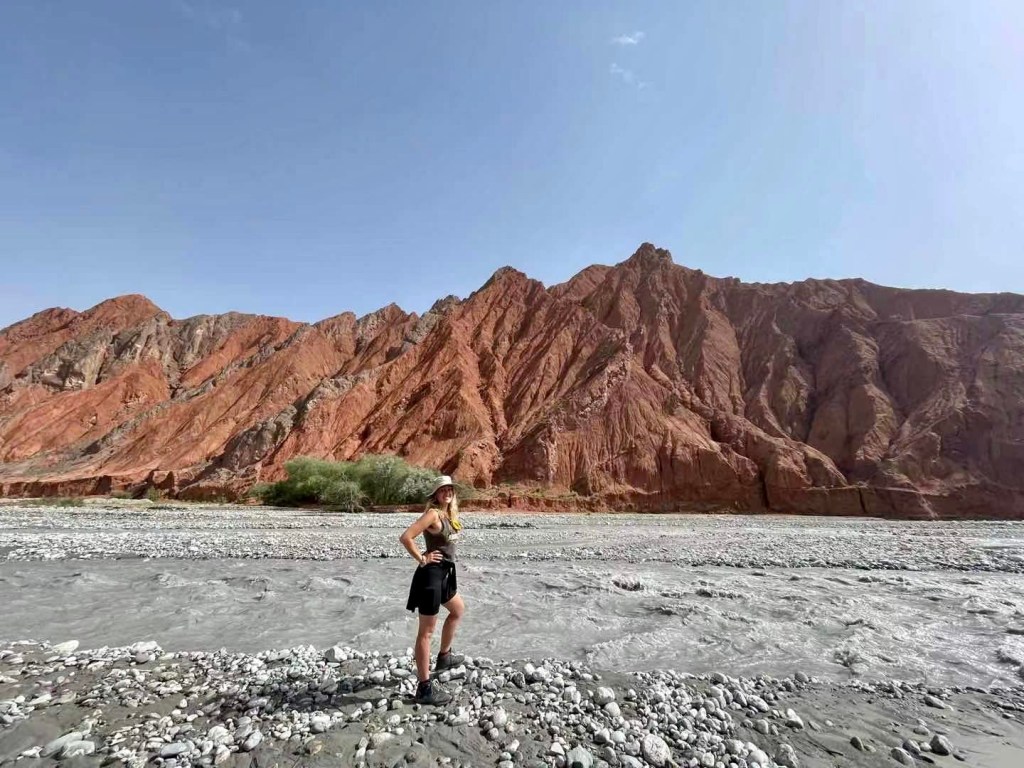
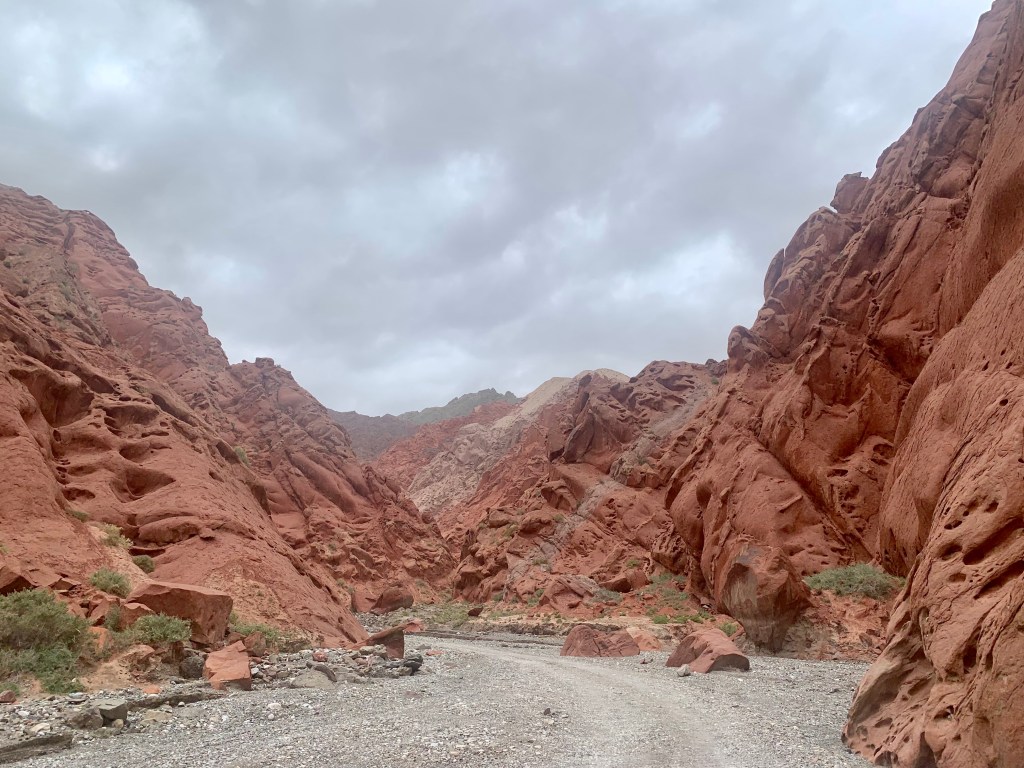
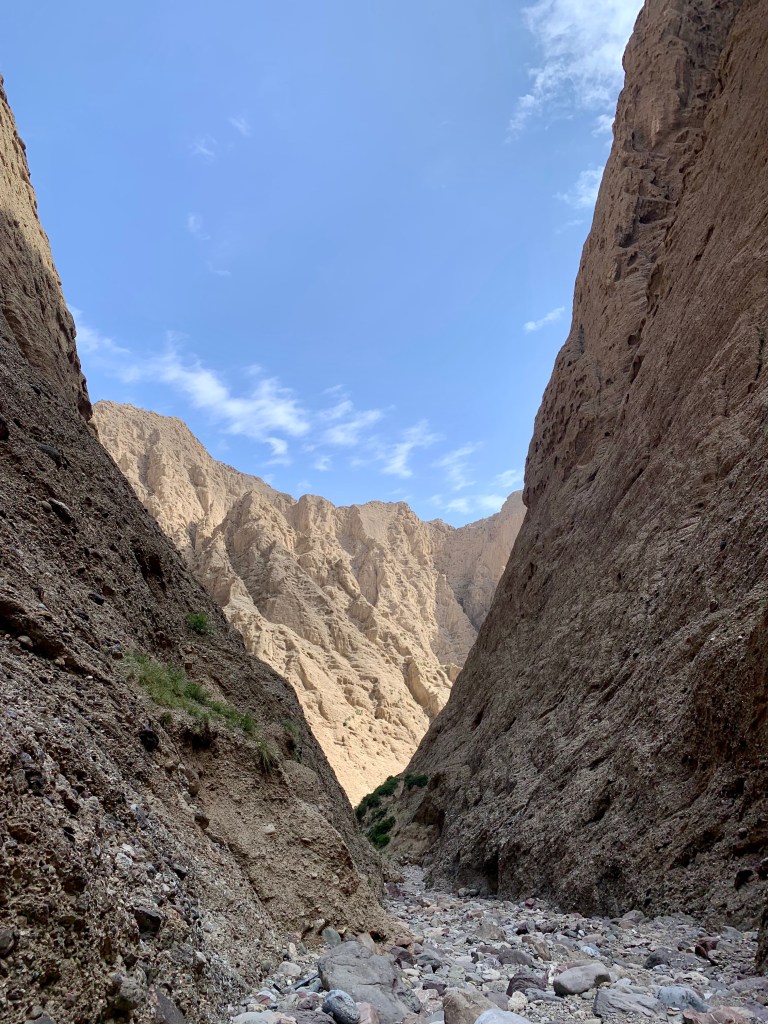
For our first quick pitstop, we stopped to get out and see Red Mountain, or Oytagh Canyon. Legend tells us that long ago, there was a dragon terrorizing the local village; when the Uyghur people finally defeated the dragon, his blood spilled onto the mountain and stained it red. (It COULD also be the amount of iron ore in the mountains, I suppose…) The stream you see is flowing directly from our next destination…
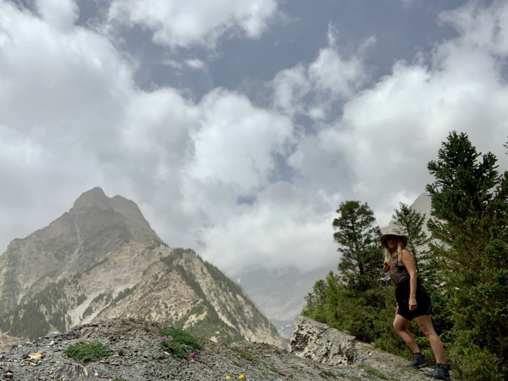
130 kilometers (about 80 miles) from Kashgar, you can find Oytagh Glacier Park, a nature park filled with rolling hills, rushing waterfalls, luscious valleys, and, of course, the Oytagh Glacier. Oytagh – which means “low lying land in the mountain” in the Uyghur language – has an elevation of 2,804 meters above sea level, making it the glacier with the lowest elevation in all of China. After the two hour drive, we were given time to ourselves to explore this beautiful park on our own.

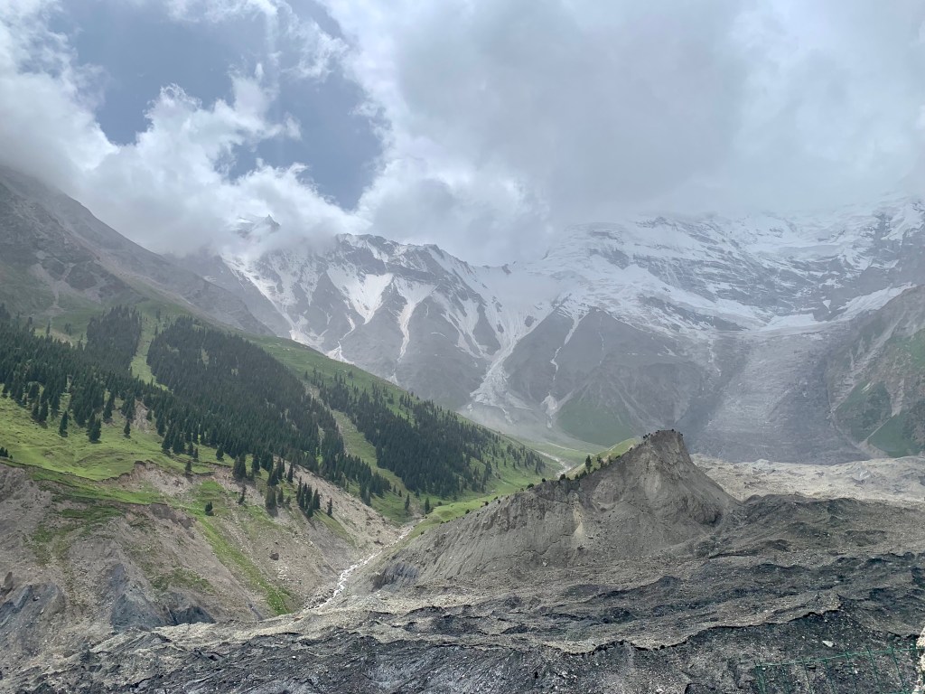
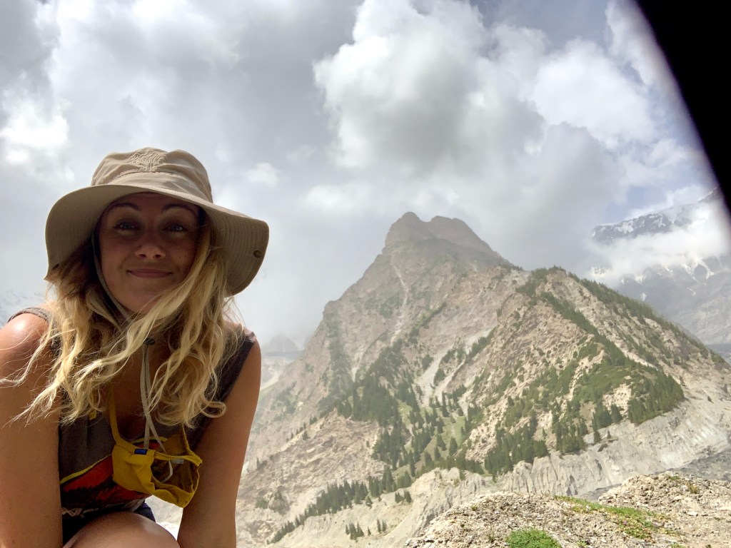
To no one’s surprise, I didn’t stay with my group for long. (In my defense: they were all walking on the paved road path. Where there were speakers. With loud music playing. And so many people. Come on now.) I found a small path leading up into the trees and decided to see where it led. After some time hiking up a pretty intense incline, my path popped me out of the trees and upon a ridge at the top of the mountain! I sat down on the edge, ate my picnic lunch, and enjoyed the peace and quiet. (And then a few local guys who also had been hiking that path came up and asked me to take a picture with them. These things happen.)


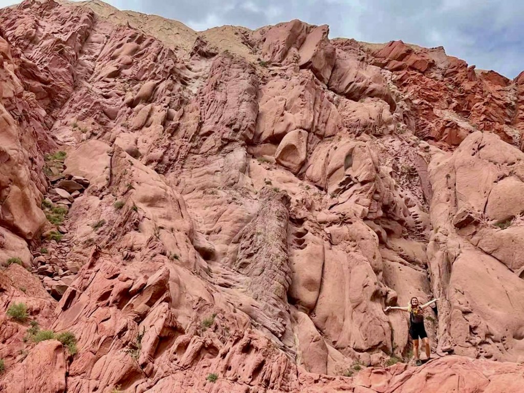
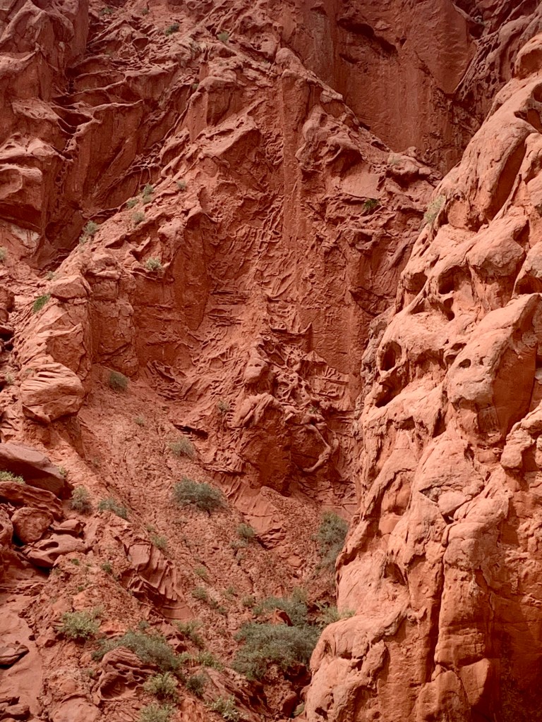
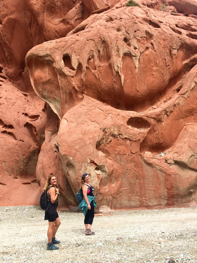
On the drive back to Kashgar for the evening, our guide brought us in to one more stop for the day. Not in any guide book that I know of, but just a spot that the locals like to come out hiking and camping. (I have no official name or scientific fun facts to offer, since I have no idea how to search for it online. So, anecdotal information will have to suffice.) With giant red mountains rising up on either side of the gravel path, it truly felt like we were suddenly exploring Mars — the strange, fascinating, wonderful scenery all around us felt like very little I had seen before. Now, I know I am always compelled by my ever-present internal adage – “If there is a big rock, you must climb it” – but, looking at these pictures, can you blame me? My rock climbing friends would have been convinced they’d died and gone to heaven.
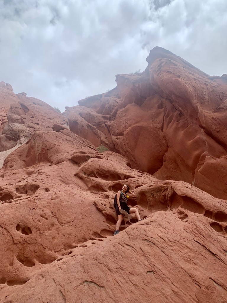

“But Madison, were you supposed to be climbing up on the rocks? No one else in your group was…”
Look, anonymous voice, my guide said it was okay. As long as I didn’t fall and blame the tour company, which, I didn’t. It’s fine, it’s fine. (Though, if I’d had more time and there wasn’t a whole group waiting and ready to go back to the van, I would have climbed MUCH higher. JUST LOOK AT IT. How could you NOT want to climb up?!)

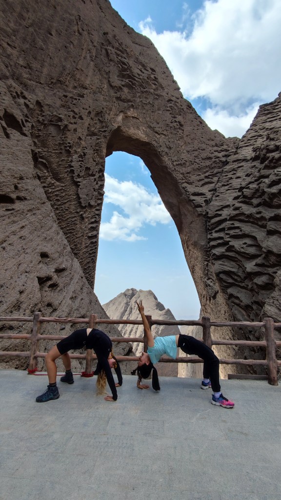
The next day, we set out for our final adventure in Xinjiang: one last hike out to reach تۆشۈك تاغ Töshük Tagh 阿图什天门, or, as it is more commonly known, Shipton’s Arch. (Quick note: if you are trying to find more information on this online, searching “Shipton’s Arch” will be what gives you more information. For my blog, I’ll be referring to it using its Uyghur name, Töshük Tagh. For reasons that I imagine will become clear in the next paragraph or so…)
Töshük Tagh, which means “hole in the mountain” or “pierced rock,” is the largest natural arch anywhere in the world; at 457 meters (about 1,500 feet!), this arch could theoretically fit the entire Empire State Building inside, even with some extra wiggle room!
Töshük Tagh was “discovered” (by the Western world) in 1947 when Eric Shipton, a famous English mountaineer who was stationed in Kashgar at the time, spotted the arch from the south while hiking. He tried to reach the arch multiple times, but was never successful. Finally, he reached out to the Uyghur locals for help, and they guided him down from the north to bring him right to the base of the arch.
After Shipton’s “discovery” (…), the newly named “Shipton’s Arch” was featured in the Guinness Book of World Records for multiple years; that is, until they deleted it because they could neither confirm the specific location nor that the arch even existed. (Why didn’t they just reach out and ask the local people to show them to the arch?? A great question to which the answer is, disappointingly but probably, racism.) For decades, Töshük Tagh was forgotten by the world at large until, in the year 2000, National Geographic sent out a team to find China’s mysterious lost arch. They were able to locate and measure Töshük Tagh and it was once again reinstated as the official largest natural arch in the world!

Our hike began on a fairly level if bumpy stone path, making our way through the mountains towering over us on either side. What was once a dangerous path – featuring ropes, rickety ladders, and falling rocks – has been updated in the past few decades to accommodate a wider range of travelers. (Not so secretly, there’s a big part of me that wishes I could have visited before the stairs were built to replace the ropes and ladders.)
Because I apparently hike like a mountain goat (according to my friend who has often traveled with me), I quickly was much further ahead on the hike than the rest of my group. I’ve mentioned this before, but I really enjoy being able to get away from other people when I’m hiking — of course I know that I’m still walking on a set path, and a well defined one in most cases, but when I am on my own without anyone else in sight it becomes easier to imagine what it might have been like to discover sites like these for the first time. I really enjoy that feeling.
After a lot of upward climbing (and a billion stairs), Töshük Tagh finally came into view.

It is impossible to try to describe in words or show you through a picture just how tall this arch is. I had to use the panorama feature on my phone to get it all in one frame. It is COLOSSAL. Leaning over the balcony, I still could not see the base of the arch. Empire State Building, remember?!
I stood up on the viewing platform staring at Töshük Tagh before me, marveling in its wonder. Eventually, the rest of my group joined me and we were all able to enjoy and appreciate this final epic view of the trip together.
Arches under arches. 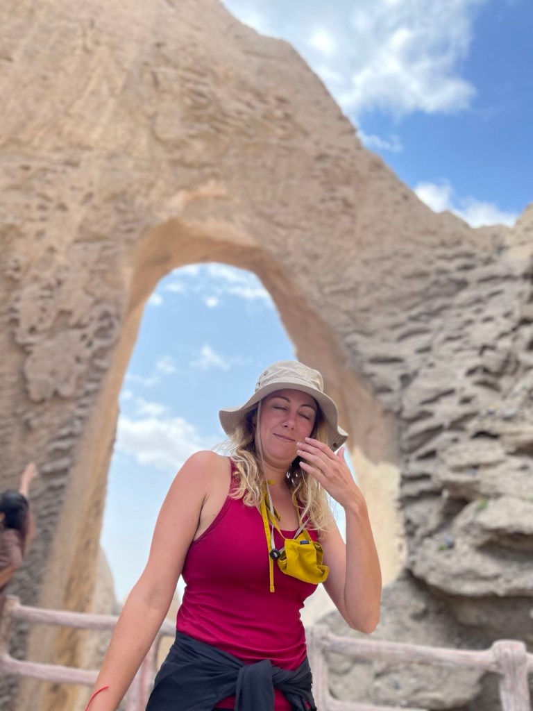
#travelinfluencer
After 15 incredible days (and the 8 blog posts it took to document it), my journey through Xinjiang came to an end. In the course of two weeks, I was able to see arctic waters, scorching deserts, luscious grasslands, towering mountains, lavender fields, ancient cities, bustling marketplaces. I learned more about the Kyrgyz, Mongol, Kazakh, and Uyghur cultures; I tasted new foods, new drinks, new candies; I searched for mysterious lake monsters and said hi to camels, sheep, horses, cows, and chickens. I’ve said it a million times before, and I will say it a million times more: I am so lucky and so thankful for this wonderful life of mine.

Though my time in Xinjiang may have been done, my travels throughout China most definitely were not. After a quick two day rest back in Shanghai, I hopped back on a plane heading in a complete different direction… Stay tuned!
