
After our journeys through the grasslands it was time to catch a flight to our next part of the Xinjiang; a place where greens of the grasslands would be replaced by the warm browns of sand and clay… Turpan!
تۇرپان Turpan 吐魯番 is located in the middle of Xinjiang, in the Turpan Basin which lies 155 meters (509 feet) below sea level! Completely surrounded by mountains and deserts on all sides, this “Valley of Winds” is known to be the hottest place in all of China; the temperature in Turpan is higher than 40 C (104 F) for 152 days each year. (Fun fact: while we were there, we saw some test models of new cars out on the road — apparently each year they bring new models out to Turpan in the summer to make sure they can handle the extreme heat!)
As an oasis amidst the scorching desert, Turpan served as an important point along the Silk Road, but scientists believe people have been living here for many years even before that – traces of human presence have been found dating back as far as 6,000 years ago! Known for its fruit (grapes!!!), its intense heat, and its ancient ruins, Turpan is an extraordinary place to learn more about the Uyghur people and their culture.


Our first stop in Turpan was the Jizhou Kiln Scenic Spot to learn about an ancient irrigation system that allows for life in Turpan: the Karez! With a surface temperature of 80 degrees Celsius (176 F), annual precipitation of less than 16 millimeters and an evaporation of as high as 3,000 millimeters, the ancient Uyghur people needed a way to find water resources and prevent evaporation. So, they built a man-made irrigation system known as the Karez which consists of underground canals, vertical wells, and small reservoirs. Every year, the melting snow from the Tian Shan Mountains flows down into the valley and is collected and stored in the Karez system for people to access. Records show that the Karez dates back to the year 103 BC, and today there are more then 1,000 Karezs with a total length of 5,000 km (3,106 miles)! Along with the Grand Canal and the Great Wall, the Turpan Karez is considered one of the three great engineering works of ancient China.


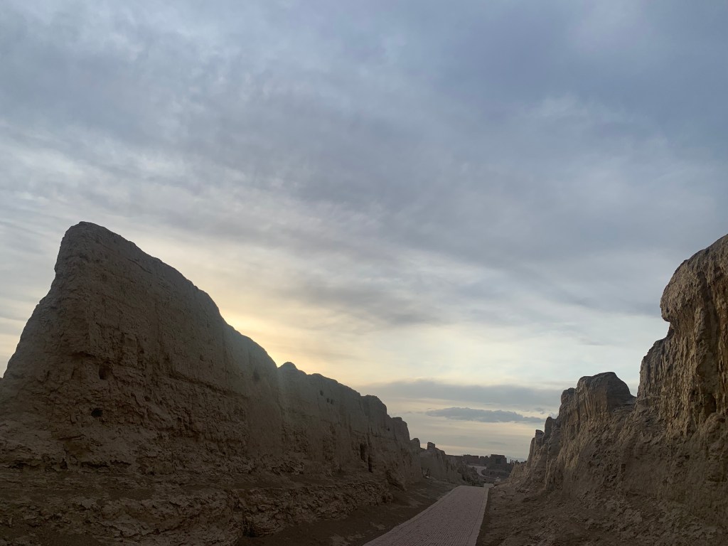
After spending the heat of the day primarily indoors and underground learning about the Karez (very necessary, that summer heat is no joke), with the last few hours of sun we drove out to see what is often considered one of Xinjiang’s most interesting archaeological sites: the ancient city of Jiaohe.

The يارغول قەدىمقى شەهىرى Jiaohe Ruins 交河故城 make up the largest, oldest, and best-preserved earthen city in the world. With a history that goes back 2,300 years, these ruins were once a rich and prosperous settlement. Jiaohe – which translates to “where two rivers meet” or “interstream area” – is constructed on a 30 meter (98 foot) cliff island plateau isolated by two braids of a river. With these natural defenses against enemy attacks, Jiaohe did not require any city walls. Thus, as one of the safest trade routes on the Silk Road, it was the prime location to serve as the ancient capital of the Cheshi Kingdom. According to historical records, it was once home to more than 700 households. In around 60 BC, Jiaohe was conquered by the Han Dynasty, followed by other kingdoms, until finally the Tang Dynasty took control in 640 AD. The buildings remaining today are believed to have been constructed during that period of time. (This is what is so hard to comprehend about China — these buildings are the NEWER construction, from the LATER inhabitants… in the year 640. It’s just wild.)
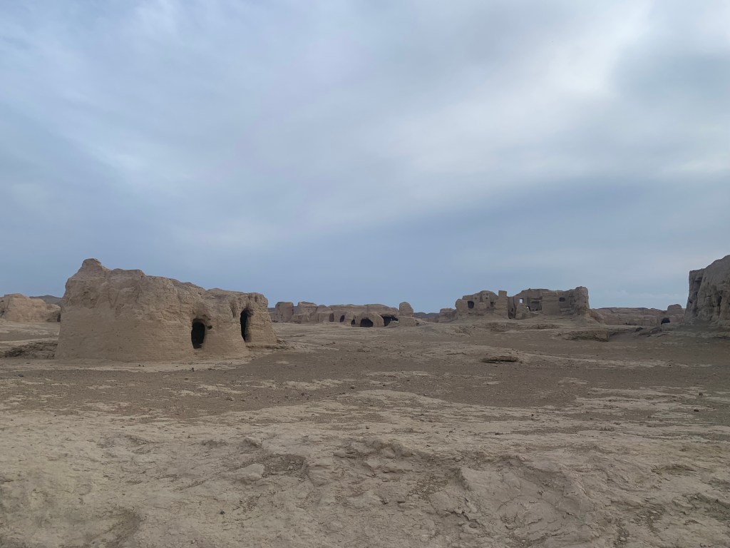


Something that makes Jaiohe unique among ruins is the way in which the city was built: all of the buildings were dug directly from the earth. The workers dug down into the ground, leaving standing structures and underground rooms remaining. These underground rooms remained cool, offering protection from the sun and strong winds. The soil that had been removed when digging was then used to build more rooms above the ground.
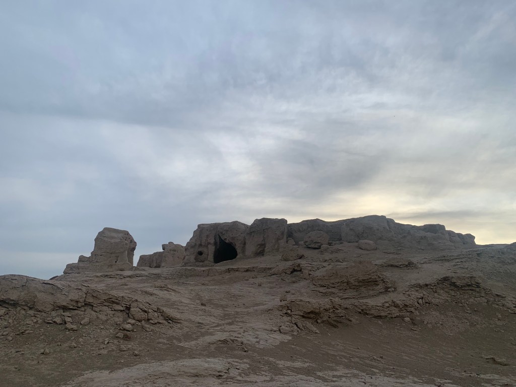


The city thrived until the beginning of the 14th century with the Mongol invasion. With many of its residents killed or taken prisoner, the remaining survivors left their fallen city. A fortress that had held strong for 2,000 years, abandoned.
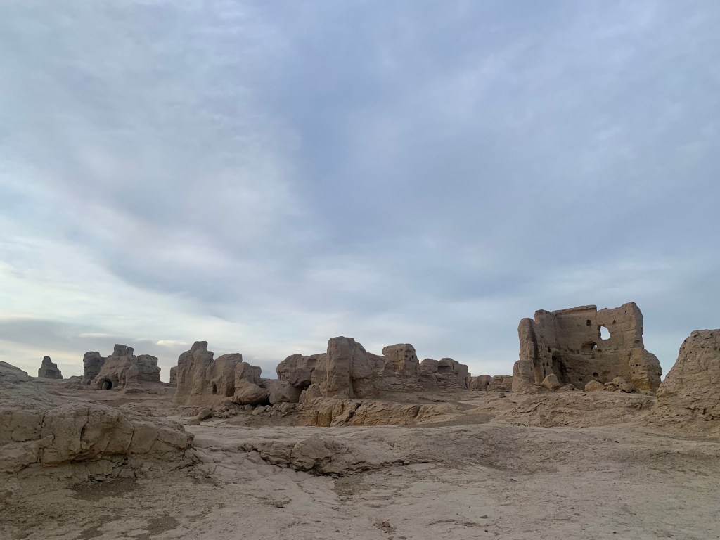
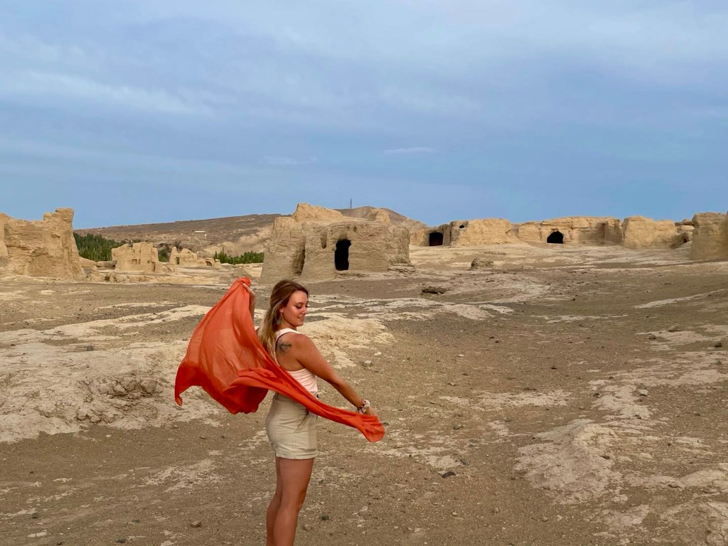
Luckily for us, due to the climate and the location, the Jiaohe Ruins have been left in almost pristine conditions. Though no longer allowed to walk freely among them (to better preserve the ruins), tourists are able to walk along paths and explore this ancient city. There’s always something both eery and special about exploring places like this; just thinking about the history of this place, of how much time has passed, of all of the many many people who made their lives here, the ties that connect us. It makes me wonder what will remain 2,000 years from now, what mark we will leave behind.
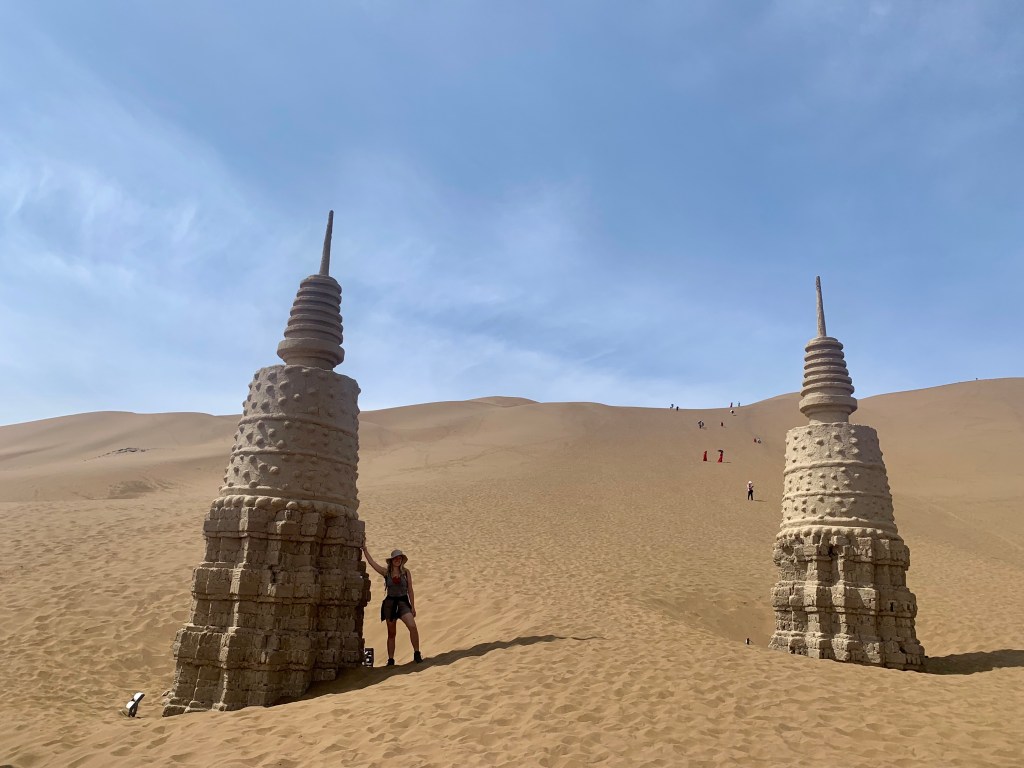
The next morning, after slathering on more sunscreen, we drove out to spend some time exploring the 库木塔格沙漠公园 Kumtag Desert Scenic Area. Kumtag (“sand mountain” in the Uyghur language) forms the eastern section of the much larger Taklamakam Desert and is the nearest desert to any city in the world! Only about 2 kilometers (a little over a mile) away from Shanshan County, the desert has never invaded the city; rather, it is said that the desert and the city “harmoniously exist.” (If I was a better weather and earth scientist, I would be able to explain how that is possible because of the winds and why they blow in certain directions and whatnot, but I am, unfortunately, not a fancy scientist and so for now this is all you’re going to get.) Some of the sand dunes in this desert can reach heights of 76 meters (250 feet) – taller than the Leaning Tower of Pisa!
We were given a bit of time to explore on our own, and a few options of things to do. Everyone else in my group decided to pay for a “desert safari” and have a driver take them up and over the dunes in a jeep! Because I am both stubborn AND cheap, I chose instead to hike up the dune myself.
A few things you should know about dune hiking in Kumtag: not only are you hiking up a fairly steep hill, you are doing it in sand which makes it infinitely more challenging. You know how when you try to run on the beach and it kind of feels like you are being sucked down into quicksand and can’t lift your legs all that well and also everything is hard? It’s that, but on an incline. And it is HOT, even through your hiking boots. My guide that came up to hike with me had been wearing flip-flips that day, thinking they would be okay since it was so hot out. Spoiler alert: they were not okay. Within the first few steps her feet started burning and she had to run back down to rent some of the shoe covers they had available at the bottom. (Reason #492 why I always wear my hiking boots.)
After the long, hot sludge to the top, it all was worth it. This was (I am pretty positive) my first real sand dune-y desert that I’ve ever experienced, and so I loved getting to stand at the top and just look out at the MASSIVE desert in front of me. Nature is so cool. What a good life.

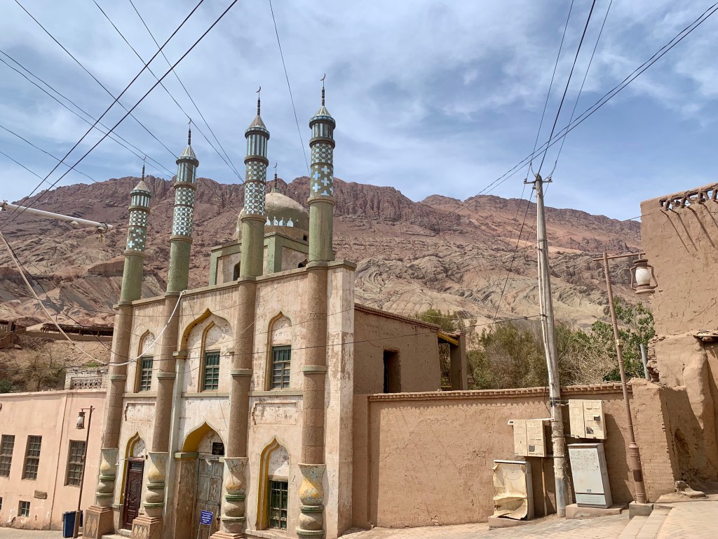
As we drove to our next stop, we passed by the famous 火焰山 Huo Yan Shan, the Flaming Mountains. This mountain range, a branch of the Tian Shan mountains, was formed 50 million years ago during the formation of the Himalayas. Sometimes, when the heat waves and the light from the sun hits just right, the mountains reflect the heat and glow of the desert and look as though they are burning. The Flaming Mountains are famous because they feature in the classic Chinese novel The Journey to the West; the Monkey King and a Buddhist monk were on their way to acquire scriptures in India when a giant wall of flames stopped them. The Monkey King had to borrow a palm-leaf fan to fan the flame so that they could continue on unharmed.

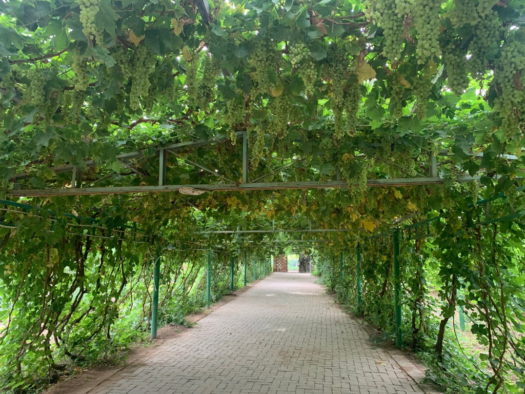
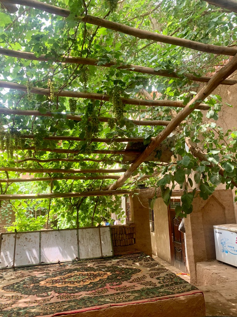
Before going on to explore at our next stop, we paused to enjoy a delicious meal in the shade. Turpan is known as the grape capital of China, and so it was very exciting to be able to enjoy some freshly picked grapes while also sitting in a room with a cascade of grape vines tumbling down above us. Between the fruit and all of the amazing Uyghur dishes we were being given, Xinjiang truly ranks up there as having some of my favorite food I’ve ever eaten while traveling.


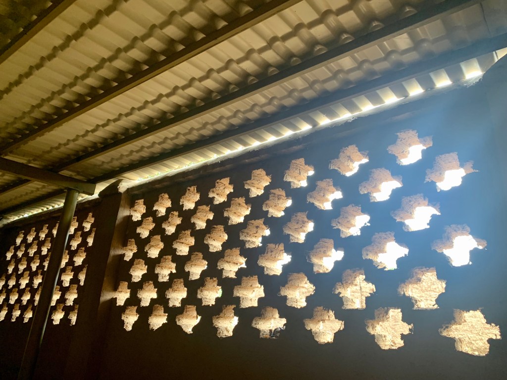
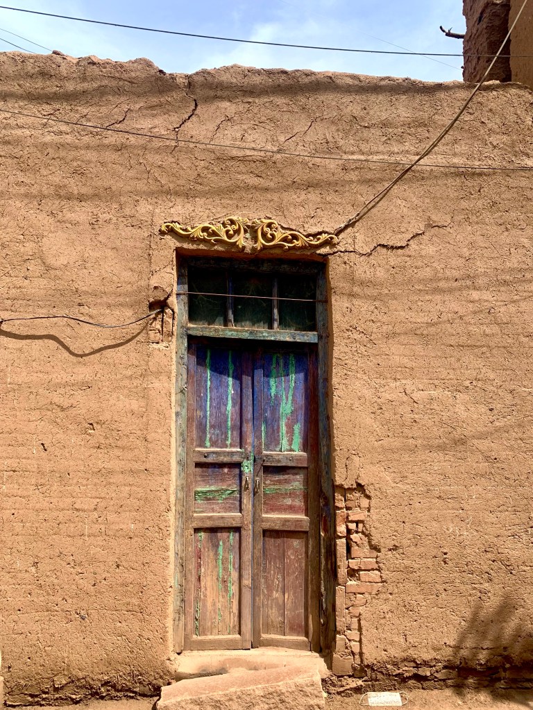
After lunch, we began to explore 吐峪沟 Tuyoq Village. With a history of more than 2,600 years, Tuyoq lies in a small valley in the Flaming Mountains and is currently home to more than 370 people who retain traditional Uyghur customs. Two-story houses built in the ancient style using mud bricks, men and women dressed in traditional local clothes, not a car in sight…
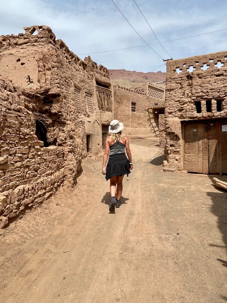
The village is small enough that we were able to wander through the streets and look around. We saw small outdoor shops selling all sorts of dried raisins and nuts (and cold water bottles — we ALL splurged for those!) and people going about their day. One of my favorite things to notice was all of the places where there once had been bright and vibrant paint that has since faded in the sun — doorways and windows and the sides of buildings, little peeps of blue, green, or yellow peeping through.
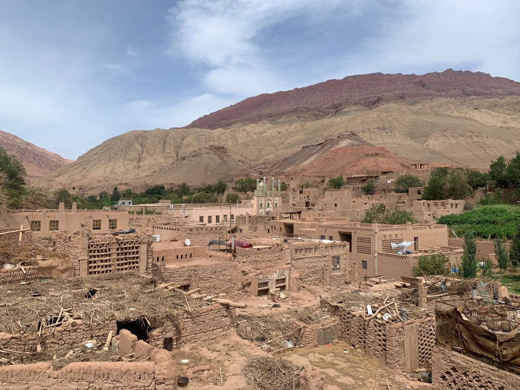

Though there were a few other people there while we were walking around, Tuyoq is not nearly as well known or popular a tourist site as so many others that I have been to. We were able to walk around and enjoy the architecture without anyone else in sight. Especially in a place like Tuyoq where traditional customs are kept, it feels a bit like walking back in time.


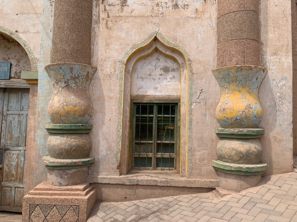
Next, we drove out just a little bit further to the 柏孜克里克千佛洞 Bezeklik Thousand Buddha Caves. First excavated during the Gaochang period (499 – 640 AD), these caves have a history than spans over 1,500 years. Inside of the caves there are beautiful colored murals, most depicting images of Buddha in various forms. However, through the years and through the course of many religious clashes over the past few centuries, many of the murals have now been destroyed or vandalized — eyes or faces scratched out, treasures removed and stolen. (Our guide mentioned that sometimes they were destroyed by those opposing the images, but sometimes were done preemptively by followers of Buddha so that it could be done on their terms and by their own hand rather than vandalized by someone else.) We were asked not to take any pictures inside the caves (which, again, some of my tour mates disregarded – this drives me CRAZY, don’t be that jerk) but it was beautiful to go through and see the art, still so beautiful after all this time.


After learning that our van’s air conditioning no longer worked (in 100+ degree heat and with multiple hours to drive), we snagged some last minute train tickets heading back to Urumqi. This is where the Northern Xinjiang tour ended, and the rest of the group would be flying back the next day. But my Southern Xinjiang tour was just beginning…

